Kazerun County
Persian: شهرستان کازرون | |
|---|---|
County | |
 Landscape in Kazerun | |
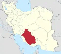
.svg.png.webp) Location of Kazerun County in Fars province | |
 Location of Fars province in Iran | |
| Coordinates: 29°29′N 51°39′E / 29.483°N 51.650°E[1] | |
| Country | |
| Province | Fars |
| Capital | Kazerun |
| Districts | Central, Jereh and Baladeh, Khesht, Konartakhteh and Kamaraj |
| Population (2016)[2] | |
| • Total | 266,217 |
| Time zone | UTC+3:30 (IRST) |
| Kazerun County can be found at GEOnet Names Server, at this link, by opening the Advanced Search box, entering "9206551" in the "Unique Feature Id" form, and clicking on "Search Database". | |
Kazerun County (Persian: شهرستان کازرون) is in Fars province, Iran. Its capital is the city of Kazerun.[3]
At the 2006 census, the county's population was 258,097, in 58,036 households.[4] The following census in 2011 counted 254,704 people in 67,262 households.[5] At the 2016 census, the county's population was 266,217 in 76,227 households.[2]
Administrative divisions
The population history and structural changes of Kazerun County's administrative divisions over three consecutive censuses are shown in the following table. The latest census shows six districts, 14 rural districts, and six cities.[2]
In 2018, Kuhmareh Rural District, Somghan Rural District, Nowdan, and Qaemiyeh were separated from the county in the establishment of Kuhchenar County.[6]
| Administrative Divisions | 2006[4] | 2011[5] | 2016[2] |
|---|---|---|---|
| Central District | 128,945 | 133,860 | 142,057 |
| Anarestan RD | |||
| Balyan RD | 17,089 | 17,468 | 17,476 |
| Dasht-e Barm RD | |||
| Deris RD | 20,503 | 20,818 | 21,785 |
| Shapur RD | 6,759 | 5,889 | 6,113 |
| Kazerun (city) | 84,594 | 89,685 | 96,683 |
| Chenar Shahijan District | 42,975 | 43,399 | 45,638 |
| Anarestan RD1 | 11,070 | 9,610 | 9,628 |
| Somghan RD2 | 8,171 | 8,434 | 9,092 |
| Qaemiyeh (city)2 | 23,734 | 25,355 | 26,918 |
| Jereh and Baladeh District | 37,315 | 34,234 | 35,524 |
| Dadin RD | 8,556 | 6,962 | 7,341 |
| Famur RD | 9,873 | 8,658 | 8,220 |
| Jereh RD | 14,950 | 14,371 | 13,991 |
| Valashahr (city)3 | 3,936 | 4,243 | 5,972 |
| Khesht District | 14,528 | 15,275 | |
| Buraki RD | 3,368 | 3,685 | |
| Emamzadeh Mohammad RD | 2,052 | 1,991 | |
| Khesht (city) | 9,108 | 9,599 | |
| Konartakhteh and Kamaraj District4 | 30,227 | 10,717 | 11,273 |
| Kamaraj RD | 4,528 | 4,171 | 4,406 |
| Konartakhteh RD5 | 8,677 | 1,068 | 786 |
| Khesht (city) | 10,332 | ||
| Konartakhteh (city) | 6,690 | 5,478 | 6,081 |
| Kuhmareh District | 18,635 | 17,156 | 16,079 |
| Dasht-e Barm RD1 | 6,690 | 5,941 | 6,135 |
| Kuhmareh RD2 | 9,356 | 8,641 | 7,052 |
| Nowdan (city)2 | 2,589 | 2,574 | 2,892 |
| Total | 258,097 | 254,704 | 266,217 |
| RD: Rural District 1Became a part of the Central District after the 2016 census[6] 2Became a part of Kuhchenar County after the 2016 census[6] 3Formerly Baladeh[7] 4Formerly Khesht and Kamaraj District[8] 5Formerly Khesht Rural District[8] | |||
Geographical location
Kazerun County is bounded by Shiraz County from the east, Kuhchenar County from the north, Bushehr province from the west and south, and Farashband County from the southeast.[9][10]
Universities and higher education centers
In Kazerun, the two top universities in Kazerun are ranked based on reputation, research performance and alumni impact.[11]
1. Salman Farsi University of Kazerun
2. Islamic Azad University, Kazerun
References
- ↑ OpenStreetMap contributors (21 September 2023). "Kazerun County" (Map). OpenStreetMap. Retrieved 21 September 2023.
- 1 2 3 4 "Census of the Islamic Republic of Iran, 1395 (2016)". AMAR (in Persian). The Statistical Center of Iran. p. 07. Archived from the original (Excel) on 6 April 2022. Retrieved 19 December 2022.
- ↑ Habibi, Hassan (21 June 1369). "Approval of the organization and chain of citizenship of the elements and units of the national divisions of Fars province, centered in Shiraz". Lamtakam (in Persian). Ministry of Interior, Council of Ministers. Archived from the original on 7 December 2023. Retrieved 7 December 2023.
- 1 2 "Census of the Islamic Republic of Iran, 1385 (2006)". AMAR (in Persian). The Statistical Center of Iran. p. 07. Archived from the original (Excel) on 20 September 2011. Retrieved 25 September 2022.
- 1 2 "Census of the Islamic Republic of Iran, 1390 (2011)". Syracuse University (in Persian). The Statistical Center of Iran. p. 07. Archived from the original (Excel) on 16 January 2023. Retrieved 19 December 2022.
- 1 2 3 Jahangiri, Ishaq (10 July 2018). "Letter of approval regarding country divisions of Kazerun County of Fars province". Qavanin (in Persian). Ministry of Interior, Board of Ministers. Archived from the original on 21 September 2023. Retrieved 21 September 2023.
- ↑ "The name of the city of Baladeh in Kazerun County was officially changed to Valashahr". Khabar Farsi (in Persian). Ministry of Interior, Board of Ministers. Archived from the original on 22 September 2023. Retrieved 22 September 2023.
- 1 2 Davodi, Parviz (9 October 2013). "Letter of approval regarding the changes and reforms of divisions in Fars province". Qavanin (in Persian). Ministry of Interior, Political and Defense Commission. Archived from the original on 21 September 2023. Retrieved 21 September 2023.
- ↑ Foundation, Encyclopaedia Iranica. "Welcome to Encyclopaedia Iranica". iranicaonline.org. Retrieved 28 January 2023.
- ↑ "Where is the geographical location of Kazerun?". Bing. Retrieved 28 January 2023.
- ↑ "2 Best Universities in Kazerun [2023 Rankings]". EduRank.org - Discover university rankings by location. 21 November 2019. Retrieved 28 January 2023.

| Capital | |||||||||||||||||||||||||||||||||||||||||||||||||||||||||||||
|---|---|---|---|---|---|---|---|---|---|---|---|---|---|---|---|---|---|---|---|---|---|---|---|---|---|---|---|---|---|---|---|---|---|---|---|---|---|---|---|---|---|---|---|---|---|---|---|---|---|---|---|---|---|---|---|---|---|---|---|---|---|
| Districts |
| ||||||||||||||||||||||||||||||||||||||||||||||||||||||||||||