Labatie-d'Andaure | |
|---|---|
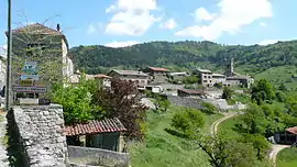 A general view of Labatie-d'Andaure | |
Location of Labatie-d'Andaure | |
 Labatie-d'Andaure 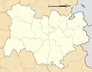 Labatie-d'Andaure | |
| Coordinates: 45°01′33″N 4°29′37″E / 45.0258°N 4.4936°E | |
| Country | France |
| Region | Auvergne-Rhône-Alpes |
| Department | Ardèche |
| Arrondissement | Tournon-sur-Rhône |
| Canton | Haut-Vivarais |
| Government | |
| • Mayor (2020–2026) | Christophe Delevoye[1] |
| Area 1 | 9.93 km2 (3.83 sq mi) |
| Population | 211 |
| • Density | 21/km2 (55/sq mi) |
| Time zone | UTC+01:00 (CET) |
| • Summer (DST) | UTC+02:00 (CEST) |
| INSEE/Postal code | 07114 /07570 |
| Elevation | 473–1,003 m (1,552–3,291 ft) (avg. 528 m or 1,732 ft) |
| 1 French Land Register data, which excludes lakes, ponds, glaciers > 1 km2 (0.386 sq mi or 247 acres) and river estuaries. | |
Labatie-d'Andaure (French pronunciation: [labati dɑ̃dɔʁ]; Occitan: La Bastia d'Andaura) is a commune in the Ardèche department in southern France.
Population
| Year | Pop. | ±% |
|---|---|---|
| 1962 | 348 | — |
| 1968 | 382 | +9.8% |
| 1975 | 307 | −19.6% |
| 1982 | 256 | −16.6% |
| 1990 | 203 | −20.7% |
| 1999 | 204 | +0.5% |
| 2008 | 197 | −3.4% |
See also
References
- ↑ "Répertoire national des élus: les maires". data.gouv.fr, Plateforme ouverte des données publiques françaises (in French). 9 August 2021.
- ↑ "Populations légales 2021". The National Institute of Statistics and Economic Studies. 28 December 2023.
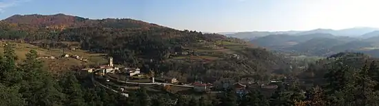
Panorama of the commune
Wikimedia Commons has media related to Labatie-d'Andaure.
This article is issued from Wikipedia. The text is licensed under Creative Commons - Attribution - Sharealike. Additional terms may apply for the media files.