Val-d'Arc | |
|---|---|
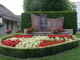 The war memorial in Randens | |
Location of Val-d'Arc | |
 Val-d'Arc 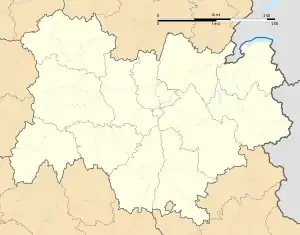 Val-d'Arc | |
| Coordinates: 45°32′42″N 6°18′39″E / 45.545°N 6.3108°E | |
| Country | France |
| Region | Auvergne-Rhône-Alpes |
| Department | Savoie |
| Arrondissement | Saint-Jean-de-Maurienne |
| Canton | Saint-Pierre-d'Albigny |
| Intercommunality | Porte de Maurienne |
| Government | |
| • Mayor (2020–2026) | José Rico[1] |
| Area 1 | 14.21 km2 (5.49 sq mi) |
| Population | 2,012 |
| • Density | 140/km2 (370/sq mi) |
| Time zone | UTC+01:00 (CET) |
| • Summer (DST) | UTC+02:00 (CEST) |
| INSEE/Postal code | 73212 /73220 |
| Elevation | 306–2,162 m (1,004–7,093 ft) |
| 1 French Land Register data, which excludes lakes, ponds, glaciers > 1 km2 (0.386 sq mi or 247 acres) and river estuaries. | |
Val-d'Arc (French pronunciation: [val daʁk], literally Vale of Arc) is a commune in the Savoie department in the Auvergne-Rhône-Alpes region in south-eastern France. It was established on 1 January 2019 by merger of the former communes of Randens (the seat) and Aiguebelle.[3]
Population
| Year | Pop. | ±% p.a. |
|---|---|---|
| 1968 | 1,779 | — |
| 1975 | 1,715 | −0.52% |
| 1982 | 1,700 | −0.13% |
| 1990 | 1,483 | −1.69% |
| 1999 | 1,564 | +0.59% |
| 2007 | 1,894 | +2.42% |
| 2012 | 1,984 | +0.93% |
| 2017 | 2,008 | +0.24% |
| Source: INSEE[4] | ||
See also
References
- ↑ "Répertoire national des élus: les maires" (in French). data.gouv.fr, Plateforme ouverte des données publiques françaises. 13 September 2022.
- ↑ "Populations légales 2021". The National Institute of Statistics and Economic Studies. 28 December 2023.
- ↑ Arrêté préfectoral 17 December 2018 (in French)
- ↑ Population en historique depuis 1968, INSEE
Wikimedia Commons has media related to Val-d'Arc.
This article is issued from Wikipedia. The text is licensed under Creative Commons - Attribution - Sharealike. Additional terms may apply for the media files.