2

I have downloaded the OSM from OpenstreeMap that came with all nodes from the map and their respective coordinates. Now I have to plot a node (latitude and longitude) on Google Map, but all coordinates goes in different places than it should be.

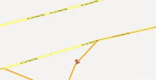
To illustrate I got the node -12.92122,-38.34991 (lat,long) on google maps and openStreetMap as you can see on screenshotsOpenStreetMap.

Google Maps

My question is how can I adjust these values.. so I can plot the node on google maps at the same place of openStreetMap.

Roberto Ferraz
  • 2,511
  • 24
  • 43
  • 1
    Roberto: you may want to direct this kind of questions to http://gis.stackexchange.com 't is like stackexchange's got a Q&A site for everything now ;-) (not a bad thing). I know that Google Earth uses WGS-84 coordinates, expressed in decimal degrees, and I _think_ that OSM uses WSG-84 as well. For fun, I moved the point to `-12.92105,-38.34975` on Google so that it would point to the same spot on OSM, but that provided no insight as to the source of this mismatch. Experts on GIS.stackexchange.com are more likely shed light on this. – mjv Oct 24 '12 at 16:55

0 Answers0