10

Does anyone know of a way to turn the output of contourLines polygons in order to plot as filled contours, as with filled.contours. Is there an order to how the polygons must then be plotted in order to see all available levels? Here is an example snippet of code that doesn't work:

#typical plot
filled.contour(volcano, color.palette = terrain.colors)

#try
cont <- contourLines(volcano)
fun <- function(x) x$level
LEVS <- sort(unique(unlist(lapply(cont, fun))))
COLS <- terrain.colors(length(LEVS))
contour(volcano)
for(i in seq(cont)){
    COLNUM <- match(cont[[i]]$level, LEVS)
    polygon(cont[[i]], col=COLS[COLNUM], border="NA")
}
contour(volcano, add=TRUE)

enter image description here

Marc in the box
  • 11,769
  • 4
  • 47
  • 97
  • can not find a complete solution but using `contour(volcano, add=TRUE)` already solves part of your problems or? – thijs van den bergh Jan 17 '13 at 13:39
  • thanks @thijsvandenbergh - I was hoping to get the actual polygons in order to try and project these onto another grid. – Marc in the box Jan 17 '13 at 13:50
  • that i dont get but this might be of help: [link](http://stackoverflow.com/questions/12849623/in-r-how-does-one-place-multiple-filled-contour-plots-in-a-single-device) – thijs van den bergh Jan 17 '13 at 13:59
  • 2
    So what is expected in your image? Other than missing a color for one polygon level, it looks reasonable. You might just need to check the values in `COLS` . For debugging, try plotting just one `cont[[k]]` at a time to see if anything is noncopascetic. – Carl Witthoft Jan 17 '13 at 15:30
  • @CarlWitthoft - I would like it to look like the `filled.contour` plot. There are a few problems: 1. the lowest contour should include the are to the corners - I suspect you are right that this is probably a matter of coding the levels correctly. 2. The center of the crater should have a level of 150, but it is over-layed by 160. – Marc in the box Jan 20 '13 at 09:50
  • Ahh, yes. The old "what to do with negative contours" problem :-(. If the source contour sets for 150 and 160 are single polygons, this is going to get messy. – Carl Witthoft Jan 20 '13 at 13:23

3 Answers3

9

A solution that uses the raster package (which calls rgeos and sp). The output is a SpatialPolygonsDataFrame that will cover every value in your grid:

library('raster')
rr <- raster(t(volcano))
rc <- cut(rr, breaks= 10)
pols <- rasterToPolygons(rc, dissolve=T)
spplot(pols)

Here's a discussion that will show you how to simplify ('prettify') the resulting polygons.

enter image description here

Noah
  • 1,404
  • 8
  • 12
  • Nicely answered -- one can see that the contours do go back down in the center, per comments above. Tho' your color choice leaves one wondering :-) :-) – Carl Witthoft Jan 20 '13 at 21:16
  • Thanks @Noah - this is a good approach. Been meaning to learn the functionality of the `raster` package anyway. Cheers. – Marc in the box Jan 21 '13 at 14:46
6

Thanks to some inspiration from this site, I worked up a function to convert contour lines to filled contours. It's set-up to process a raster object and return a SpatialPolygonsDataFrame.

raster2contourPolys <- function(r, levels = NULL) {

  ## set-up levels
  levels <- sort(levels)
  plevels <- c(min(values(r), na.rm=TRUE), levels, max(values(r), na.rm=TRUE)) # pad with raster range
  llevels <- paste(plevels[-length(plevels)], plevels[-1], sep=" - ")  
  llevels[1] <- paste("<", min(levels))
  llevels[length(llevels)] <- paste(">", max(levels))

  ## convert raster object to matrix so it can be fed into contourLines
  xmin <- extent(r)@xmin
  xmax <- extent(r)@xmax
  ymin <- extent(r)@ymin
  ymax <- extent(r)@ymax
  rx <- seq(xmin, xmax, length.out=ncol(r))
  ry <- seq(ymin, ymax, length.out=nrow(r))
  rz <- t(as.matrix(r))
  rz <- rz[,ncol(rz):1] # reshape

  ## get contour lines and convert to SpatialLinesDataFrame
  cat("Converting to contour lines...\n")
  cl <- contourLines(rx,ry,rz,levels=levels) 
  cl <- ContourLines2SLDF(cl)

  ## extract coordinates to generate overall boundary polygon
  xy <- coordinates(r)[which(!is.na(values(r))),]
  i <- chull(xy)
  b <- xy[c(i,i[1]),]
  b <- SpatialPolygons(list(Polygons(list(Polygon(b, hole = FALSE)), "1")))

  ## add buffer around lines and cut boundary polygon
  cat("Converting contour lines to polygons...\n")
  bcl <- gBuffer(cl, width = 0.0001) # add small buffer so it cuts bounding poly
  cp <- gDifference(b, bcl)

  ## restructure and make polygon number the ID
  polys <- list() 
  for(j in seq_along(cp@polygons[[1]]@Polygons)) {
    polys[[j]] <- Polygons(list(cp@polygons[[1]]@Polygons[[j]]),j)
  }
  cp <- SpatialPolygons(polys)
  cp <- SpatialPolygonsDataFrame(cp, data.frame(id=seq_along(cp)))

  ## cut the raster by levels
  rc <- cut(r, breaks=plevels)

  ## loop through each polygon, create internal buffer, select points and define overlap with raster
  cat("Adding attributes to polygons...\n")
  l <- character(length(cp))
  for(j in seq_along(cp)) {
    p <- cp[cp$id==j,] 
    bp <- gBuffer(p, width = -max(res(r))) # use a negative buffer to obtain internal points
    if(!is.null(bp)) {
      xy <- SpatialPoints(coordinates(bp@polygons[[1]]@Polygons[[1]]))[1]
      l[j] <- llevels[extract(rc,xy)]
    } 
    else { 
      xy <- coordinates(gCentroid(p)) # buffer will not be calculated for smaller polygons, so grab centroid
      l[j] <- llevels[extract(rc,xy)]
    } 
  }

  ## assign level to each polygon
  cp$level <- factor(l, levels=llevels)
  cp$min <- plevels[-length(plevels)][cp$level]
  cp$max <- plevels[-1][cp$level]  
  cp <- cp[!is.na(cp$level),] # discard small polygons that did not capture a raster point
  df <- unique(cp@data[,c("level","min","max")]) # to be used after holes are defined
  df <- df[order(df$min),]
  row.names(df) <- df$level
  llevels <- df$level

  ## define depressions in higher levels (ie holes)
  cat("Defining holes...\n")
  spolys <- list()
  p <- cp[cp$level==llevels[1],] # add deepest layer
  p <- gUnaryUnion(p)
  spolys[[1]] <- Polygons(p@polygons[[1]]@Polygons, ID=llevels[1])
  for(i in seq(length(llevels)-1)) {
    p1 <- cp[cp$level==llevels[i+1],] # upper layer
    p2 <- cp[cp$level==llevels[i],] # lower layer
    x <- numeric(length(p2)) # grab one point from each of the deeper polygons
    y <- numeric(length(p2))
    id <- numeric(length(p2))
    for(j in seq_along(p2)) {
      xy <- coordinates(p2@polygons[[j]]@Polygons[[1]])[1,]
      x[j] <- xy[1]; y[j] <- xy[2]
      id[j] <- as.numeric(p2@polygons[[j]]@ID)
    }
    xy <- SpatialPointsDataFrame(cbind(x,y), data.frame(id=id))
    holes <- over(xy, p1)$id
    holes <- xy$id[which(!is.na(holes))]
    if(length(holes)>0) {
      p2 <- p2[p2$id %in% holes,] # keep the polygons over the shallower polygon
      p1 <- gUnaryUnion(p1) # simplify each group of polygons
      p2 <- gUnaryUnion(p2)
      p <- gDifference(p1, p2) # cut holes in p1      
    } else { p <- gUnaryUnion(p1) }
    spolys[[i+1]] <- Polygons(p@polygons[[1]]@Polygons, ID=llevels[i+1]) # add level 
  }
  cp <- SpatialPolygons(spolys, pO=seq_along(llevels), proj4string=CRS(proj4string(r))) # compile into final object
  cp <- SpatialPolygonsDataFrame(cp, df)
  cat("Done!")
  cp

}

It probably holds several inefficiencies, but it has worked well in the tests I've conducted using bathymetry data. Here's an example using the volcano data:

r <- raster(t(volcano))
l <- seq(100,200,by=10)
cp <- raster2contourPolys(r, levels=l)
cols <- terrain.colors(length(cp))
plot(cp, col=cols, border=cols, axes=TRUE, xaxs="i", yaxs="i")
contour(r, levels=l, add=TRUE)
box()

enter image description here

Paul Regular
  • 498
  • 4
  • 8
  • This isn't bad, but not all polygons are spatially exclusive - try adding `plot(cp[4,], add=T, col='black')` - which will cause problems for both analysis and visualisation (requiring specific plot order, precluding transparency, etc). `gDifference` might be your friend here. – geotheory Oct 16 '16 at 17:58
2

Building on the excellent work of Paul Regular, here is a version that should ensure exclusive polygons (i.e. no overlapping).

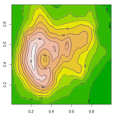
I've added a new argument fd for fairy dust to address an issue I discovered working with UTM-type coordinates. Basically as I understand the algorithm works by sampling lateral points from the contour lines to determine which side is inside the polygon. The distance of the sample point from the line can create problems if it ends up in e.g. behind another contour. So if your resulting polygons looks wrong try setting fd to values 10^±n until it looks very wrong or about right..

raster2contourPolys <- function(r, levels = NULL, fd = 1) {
  ## set-up levels
  levels <- sort(levels)
  plevels <- c(min(values(r)-1, na.rm=TRUE), levels, max(values(r)+1, na.rm=TRUE)) # pad with raster range
  llevels <- paste(plevels[-length(plevels)], plevels[-1], sep=" - ")  
  llevels[1] <- paste("<", min(levels))
  llevels[length(llevels)] <- paste(">", max(levels))

  ## convert raster object to matrix so it can be fed into contourLines
  xmin <- extent(r)@xmin
  xmax <- extent(r)@xmax
  ymin <- extent(r)@ymin
  ymax <- extent(r)@ymax
  rx <- seq(xmin, xmax, length.out=ncol(r))
  ry <- seq(ymin, ymax, length.out=nrow(r))
  rz <- t(as.matrix(r))
  rz <- rz[,ncol(rz):1] # reshape

  ## get contour lines and convert to SpatialLinesDataFrame
  cat("Converting to contour lines...\n")
  cl0 <- contourLines(rx, ry, rz, levels = levels)
  cl <- ContourLines2SLDF(cl0)

  ## extract coordinates to generate overall boundary polygon
  xy <- coordinates(r)[which(!is.na(values(r))),]
  i <- chull(xy)
  b <- xy[c(i,i[1]),]
  b <- SpatialPolygons(list(Polygons(list(Polygon(b, hole = FALSE)), "1")))

  ## add buffer around lines and cut boundary polygon
  cat("Converting contour lines to polygons...\n")
  bcl <- gBuffer(cl, width = fd*diff(bbox(r)[1,])/3600000) # add small buffer so it cuts bounding poly
  cp <- gDifference(b, bcl)

  ## restructure and make polygon number the ID
  polys <- list()
  for(j in seq_along(cp@polygons[[1]]@Polygons)) {
    polys[[j]] <- Polygons(list(cp@polygons[[1]]@Polygons[[j]]),j)
  }
  cp <- SpatialPolygons(polys)
  cp <- SpatialPolygonsDataFrame(cp, data.frame(id=seq_along(cp)))

  # group by elev (replicate ids)
  # ids = sapply(slot(cl, "lines"), slot, "ID")
  # lens = sapply(1:length(cl), function(i) length(cl[i,]@lines[[1]]@Lines))

  ## cut the raster by levels
  rc <- cut(r, breaks=plevels)

  ## loop through each polygon, create internal buffer, select points and define overlap with raster
  cat("Adding attributes to polygons...\n")
  l <- character(length(cp))
  for(j in seq_along(cp)) {
    p <- cp[cp$id==j,] 
    bp <- gBuffer(p, width = -max(res(r))) # use a negative buffer to obtain internal points
    if(!is.null(bp)) {
      xy <- SpatialPoints(coordinates(bp@polygons[[1]]@Polygons[[1]]))[1]
      l[j] <- llevels[raster::extract(rc,xy)]
    } 
    else { 
      xy <- coordinates(gCentroid(p)) # buffer will not be calculated for smaller polygons, so grab centroid
      l[j] <- llevels[raster::extract(rc,xy)]
    }
  }

  ## assign level to each polygon
  cp$level <- factor(l, levels=llevels)
  cp$min <- plevels[-length(plevels)][cp$level]
  cp$max <- plevels[-1][cp$level]  
  cp <- cp[!is.na(cp$level),] # discard small polygons that did not capture a raster point
  df <- unique(cp@data[,c("level","min","max")]) # to be used after holes are defined
  df <- df[order(df$min),]
  row.names(df) <- df$level
  llevels <- df$level

  ## define depressions in higher levels (ie holes)
  cat("Defining holes...\n")
  spolys <- list()
  p <- cp[cp$level==llevels[1],] # add deepest layer
  p <- gUnaryUnion(p)
  spolys[[1]] <- Polygons(p@polygons[[1]]@Polygons, ID=llevels[1])
  for(i in seq(length(llevels)-1)) {
    p1 <- cp[cp$level==llevels[i+1],] # upper layer
    p2 <- cp[cp$level==llevels[i],] # lower layer
    x <- numeric(length(p2)) # grab one point from each of the deeper polygons
    y <- numeric(length(p2))
    id <- numeric(length(p2))
    for(j in seq_along(p2)) {
      xy <- coordinates(p2@polygons[[j]]@Polygons[[1]])[1,]
      x[j] <- xy[1]; y[j] <- xy[2]
      id[j] <- as.numeric(p2@polygons[[j]]@ID)
    }
    xy <- SpatialPointsDataFrame(cbind(x,y), data.frame(id=id))
    holes <- over(xy, p1)$id
    holes <- xy$id[which(!is.na(holes))]
    if(length(holes)>0) {
      p2 <- p2[p2$id %in% holes,] # keep the polygons over the shallower polygon
      p1 <- gUnaryUnion(p1) # simplify each group of polygons
      p2 <- gUnaryUnion(p2)
      p <- gDifference(p1, p2) # cut holes in p1      
    } else { p <- gUnaryUnion(p1) }
    spolys[[i+1]] <- Polygons(p@polygons[[1]]@Polygons, ID=llevels[i+1]) # add level 
  }
  cp <- SpatialPolygons(spolys, pO=seq_along(llevels), proj4string=CRS(proj4string(r))) # compile into final object

  ## make polygons exclusive (i.e. no overlapping)
  cpx = gDifference(cp[1,], cp[2,], id=cp[1,]@polygons[[1]]@ID)
  for(i in 2:(length(cp)-1)) cpx = spRbind(cpx, gDifference(cp[i,], cp[i+1,], id=cp[i,]@polygons[[1]]@ID))
  cp = spRbind(cpx, cp[length(cp),])

  ## it's a wrap
  cp <- SpatialPolygonsDataFrame(cp, df)
  cat("Done!")
  cp
}
geotheory
  • 22,624
  • 29
  • 119
  • 196