I have drawn a polygon on google map(with certain lats and lngs) now I would like to grow the outer of this polygon by 40 meters(input from users). How can I achieve this? Thank you

Thank you @geocodezip, I tried buffering polygon data(without using center point of polygon) and got this

distance between black and red lines seems not same.
Thanks for all replies && answers! I found a way to do that without buffering polygon/polylines data. Should have a better way to do this. But I would like to share what I have done in here:
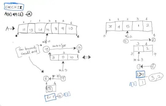
- I know two gps points: A and B so I could get bearing between those two points.
- Based on this bearing I could get the bearing between A and the point(C) 40 meters away from A because line between A and C is 90 degrees against the line between A and B
- With the new bearing and distance(40m) I could get the gps point of C (How to calculate the latlng of a point a certain distance away from another?)
- finally do step from 1~3 again with point from B to A
Here is a screenshot of what I have done (I have not finish yet, will upload a final screenshot later.)


