I have a script that generates a continuous regular grid (i.e., a geopandas.GeoSeries) that is composed solely of shapely.geometry.BBox instances. This script runs correctly in a single-core. Given the fact that this kind of operation can take a long time to process for small grid cell sizes when one is interested in large surface areas, I have developed a new version of the script so to run in parallel.
This new parallelized version basically applies the same original script to subsets of the original region of Interest (ROI). This approach is expected to positively impact the time consumption of one's computer. Nevertheless, there seems to be a problem with the concatenation of the grids between the different Core results, and that is where the problem lies.
As it seems, parallel processing can cause some small errors in one analysis, forcefully causing these "GAPs" in the result.
Here is the first (single-core script):
#!/usr/bin/env python
# coding: utf-8


# Ref:

# https://stackoverflow.com/questions/40342355/how-can-i-generate-a-regular-geographic-grid-using-python


from cartopy.io import shapereader
import shapely
import pyproj
import geopandas as gpd
from time import time
import pandas as pd
import copy
import matplotlib.pyplot as plt


def get_bounds(df: gpd.GeoDataFrame,
               country=str,
               colname='ABBREV') -> tuple:
    """Get Bounds from Geopandas.

    Parameters
    ----------
    df : gpd.GeoDataFrame
        DESCRIPTION.
    country : TYPE, optional
        DESCRIPTION. The default is str.
    colname : TYPE, optional
        DESCRIPTION. The default is 'ABBREV'.

    Returns
    -------
    tuple (ROI,
           Geopandas.GeoSeries)
        ROI = shapely.geometry.box(minx, miny, maxx, maxy)
        Geopandas.GeoSeries

    """
    mask = df[colname].str.contains(country).fillna(False)

    c_df = df[mask]

    minx, miny, maxx, maxy = c_df.geometry.total_bounds

    ROI = shapely.geometry.box(minx, miny, maxx, maxy)

    return ROI, c_df.geometry


def getRoi():
    """Generate a ROI for Brazil.

    Returns
    -------
    ROI : TYPE
        DESCRIPTION.
    geometry : TYPE
        DESCRIPTION.

    """
    # # Fetching some basic data

    # Get geometries
    shpfilename = shapereader.natural_earth(resolution='50m',
                                            category='cultural',
                                            name='admin_0_countries')
    reader = shapereader.Reader(shpfilename)

    Countries = pd.DataFrame()

    for x in reader.records():
        S = pd.Series(x.attributes)
        S['geometry'] = x.geometry

        Countries = Countries.append(S, ignore_index=True)

    Countries = gpd.GeoDataFrame(Countries, crs="EPSG:4326")

    # Determine bounding box
    ROI, geometry = get_bounds(Countries, 'Brazil')

    return ROI, geometry


class RegularGridder():
    def __init__(self,
                 origin_crs,
                 target_crs):
        self._transformer = pyproj.Transformer.from_crs(
            origin_crs, target_crs, always_xy=True)

    @property
    def transformer(self) -> pyproj.Transformer:
        """Retrieve the pyproj.Transformer for reprojecting data coordinates.

        Returns
        -------
        pyproj.Transformer

        """
        return self._transformer

    @transformer.setter
    def transformer(self,
                    transformer: pyproj.Transformer):
        """Reset the pyproj.transformer instance.

        Parameters
        ----------
        pyproj.Transformer
            DESCRIPTION.

        Returns
        -------
        pyproj.Transformer

        """
        if not isinstance(transformer, pyproj.Transformer):
            msg = ("The provided Transformer is not of correct Type. \n" +
                   "\tType expected: {0}; \n\tActual type {1}"
                   )
            raise TypeError(msg.format(pyproj.Transformer,
                                       type(transformer)
                                       )
                            )
        else:
            self._transformer = transformer

            return self._transformer

    def generate_regularGrid(self,
                             xmin,
                             ymin,
                             xmax,
                             ymax,
                             dx=5,  # in target units
                             dy=5,  # in target units
                             return_grid_in_original_crs=False,
                             verbose=False) -> gpd.GeoSeries:
        """Generate a Regular Gridded Surface.

        Parameters
        ----------
        xmin : Float
            DESCRIPTION.
        ymin : Float
            DESCRIPTION.
        xmax : Float
            DESCRIPTION.
        ymax : Float
            DESCRIPTION.
        origin_crs : TYPE
            DESCRIPTION.
        target_crs : TYPE
            DESCRIPTION.
        dx : Float, optional.
            the spacing distance between grid (in target units).
                The default is 5.
        dy : Float, optional.
            the spacing distance between grid (in target units).
                The default is 5.
        return_grid_in_original_crs : Bool, optional
            Boolean parameter that constrols whether the grid should
            be returned in the original crs, or not.
            If True, the grid will be returned in the original crs
            If False (default), the grid will be returned in the target crs.

        verbose : Bool, optional
            DESCRIPTION. The default is False.

        Returns
        -------
        RegularGrid : geopandas.GeoSeries
            the regular grid.
        dt : datetime.timedelta
            The timedelta taken for generating this grid.
        """
        T0 = time()

        RegularGrid = []

        xmin, ymin = self.transformer.transform(xmin, ymin)

        xmax, ymax = self.transformer.transform(xmax, ymax)

        x = copy.copy(xmin) - 2*dx

        while x <= xmax:
            if verbose:
                print(
                    'x <= xmax : {0:.4f} <- {1:.4f}: {2}'.format(x,
                                                                 xmax,
                                                                 x < xmax)
                )
            y = copy.copy(ymin) - 2*dy
            while y <= ymax:
                if verbose:
                    print(
                        'y <= ymax : {0:.4f} <- {1:.4f}: {2}'.format(y,
                                                                     ymax,
                                                                     x < ymax)
                    )

                p = shapely.geometry.box(x, y, x + dx, y + dy)
                RegularGrid.append(p)
                y += dy
            x += dx

        RegularGrid = gpd.GeoSeries(RegularGrid,
                                    crs=self.transformer.target_crs.to_wkt(),
                                    name='geometry')

        if return_grid_in_original_crs:

            RegularGrid = RegularGrid.to_crs(
                self.transformer.source_crs.to_wkt()
            )

        dt = time() - T0
        if verbose:
            print('Serial Time Taken: {0}'.format(dt))

        return RegularGrid, dt


if "__main__" == __name__:

    ROI, GeoSeries = getRoi()

    # Choosing a projected coordinate system
    #     (therefore, in meters for a given ROI)

    T0 = time()
    return_grid_in_original_crs = False
    regGridder = RegularGridder(origin_crs='epsg:4326',
                                target_crs='epsg:5880')

    RegularGrid, dt = regGridder.generate_regularGrid(*ROI.bounds,
                                                      dx=200000,
                                                      dy=200000,
                                                      return_grid_in_original_crs=return_grid_in_original_crs,
                                                      verbose=False)
    import cartopy.crs as ccrs
    from pyproj.crs import CRS
    if return_grid_in_original_crs:
        projection = ccrs.PlateCarree()
        fig, ax = plt.subplots(subplot_kw={"projection": projection})
        GeoSeries = GeoSeries.to_crs(RegularGrid.crs)

        GeoSeries.plot(ax=ax,
                       facecolor='blue', transform=projection)
        RegularGrid.plot(ax=ax, transform=projection,
                         edgecolor='k',
                         facecolor=(0.5, 0.5, 0.5, 0.2))
        fig.show()
    else:
        projection = None
        fig, ax = plt.subplots()
        GeoSeries = GeoSeries.to_crs(RegularGrid.crs)

        GeoSeries.plot(ax=ax,
                       facecolor='blue')
        RegularGrid.plot(ax=ax,
                         edgecolor='k',
                         facecolor=(0.5, 0.5, 0.5, 0.2))
        fig.show()

    dt = time() - T0
    print('Time Taken: {0}'.format(dt))
And here is the parallelized version of the above script:
# Ref:

# https://stackoverflow.com/questions/40342355/how-can-i-generate-a-regular-geographic-grid-using-python

from multiprocessing import Pool
import shapely
import pyproj
import geopandas as gpd
import numpy as np
from time import time
import pandas as pd
import copy
import matplotlib.pyplot as plt
import os

from serial_gridding import getRoi


def splitGrid(xmin,
              ymin,
              xmax,
              ymax,
              nsplits,
              decimals=7  # in target units
              ):
    dx = (xmax - xmin)/nsplits
    dy = (ymax - ymin)/nsplits

    XBlocks = np.arange(xmin, xmax + dx, dx)
    XBlocks = [(xmin, xmax) for xmin, xmax in zip(XBlocks[:-1], XBlocks[1:])]
    YBlocks = np.arange(ymin, ymax + dy, dy)
    YBlocks = [(ymin, ymax) for ymin, ymax in zip(YBlocks[:-1], YBlocks[1:])]

    return XBlocks, YBlocks


def generate_regularGrid(xmin: float,
                         ymin: float,
                         xmax: float,
                         ymax: float,
                         origin_crs: str,
                         target_crs: str,
                         dx=5,  # in target units
                         dy=5,  # in target units
                         return_grid_in_original_crs=False,
                         verbose=False) -> gpd.GeoSeries:
    """Generate a Regular Gridded Surface.

    Parameters
    ----------
    xmin : Float
        DESCRIPTION.
    ymin : Float
        DESCRIPTION.
    xmax : Float
        DESCRIPTION.
    ymax : Float
        DESCRIPTION.
    origin_crs : TYPE
        DESCRIPTION.
    target_crs : TYPE
        DESCRIPTION.
    dx : Float, optional.
        the spacing distance between grid (in target units). The default is 5.
    dy : Float, optional.
        the spacing distance between grid (in target units). The default is 5.
    return_grid_in_original_crs : Bool, optional
        Boolean parameter that controls whether the grid should
        be returned in the original CRS, or not.
        If True, the grid will be returned in the original CRS
        If False (default), the grid will be returned in the target CRS.

    verbose : Bool, optional
        DESCRIPTION. The default is False.

    Returns
    -------
    RegularGrid : geopandas.GeoSeries
        the regular grid.
    dt : datetime.timedelta
        The timedelta taken for generating this grid.

    """

    RegularGrid = []

    x = xmin

    while x <= xmax:
        if verbose:
            print(
                'x <= xmax : {0:.4f} <- {1:.4f}: {2}'.format(x,
                                                             xmax,
                                                             x < xmax)
            )
        y = ymin
        while y <= ymax:
            if verbose:
                print(
                    'y <= ymax : {0:.4f} <- {1:.4f}: {2}'.format(y,
                                                                 ymax,
                                                                 x < ymax)
                )

            p = shapely.geometry.box(x, y, x + dx, y + dy)
            RegularGrid.append(p)
            y += dy
        x += dx

    RegularGrid = gpd.GeoSeries(RegularGrid,
                                crs=target_crs,
                                name='geometry')

    if return_grid_in_original_crs:

        RegularGrid = RegularGrid.to_crs(origin_crs)

    return RegularGrid


def solveOverlappingPolygons(geoSeries):
    polygons = geoSeries.geometry
    non_overlapping = []
    for n, p in enumerate(polygons[:-1], 1):
        if not any(p.overlaps(g) for g in polygons[n:]):
            non_overlapping.append(p)

    RegularGrid = gpd.GeoSeries(non_overlapping,
                                crs=geoSeries.crs,
                                name=geoSeries.name)
    return RegularGrid


def _parallelGridding(listOfBounds,
                      nProcesses=None,
                      origin_crs='epsg:4326',
                      target_crs='epsg:5880',
                      dx=500_000,
                      dy=500_000,
                      return_grid_in_original_crs=True,
                      verbose=False):

    T0 = time()

    iterables = [(xmin, ymin, xmax, ymax,
                  origin_crs,
                  target_crs,
                  dx,
                  dy,
                  return_grid_in_original_crs,
                  verbose) for (xmin, ymin, xmax, ymax) in listOfBounds]

    with Pool(nProcesses) as p:
        Results = p.starmap(generate_regularGrid, iterables)

    geoSeries = pd.concat(Results)
    geoSeries = solveOverlappingPolygons(geoSeries)
    dt = time() - T0
    if verbose:
        print('Parallel Processing Time Taken: {0}'.format(dt))
    return geoSeries, dt


def parallelGridding(roi,
                     nsplits,
                     nProcesses,
                     origin_crs,
                     target_crs,
                     decimals,
                     *args,
                     **kwargs
                     ):
    (xmin,
     ymin,
     xmax,
     ymax) = roi.bounds

    Transformer = pyproj.Transformer.from_crs(
        origin_crs, target_crs, always_xy=True)

    xmin, ymin = Transformer.transform(xmin, ymin)

    xmax, ymax = Transformer.transform(xmax, ymax)

    xmin = copy.copy(xmin) - 2*kwargs.get("dx")
    ymin = copy.copy(ymin) - 2*kwargs.get("dy")

    XBlocks, YBlocks = splitGrid(xmin, ymin, xmax, ymax, nsplits=nsplits,
                                 decimals=decimals)

    listOfBounds = [(xmin, ymin, xmax, ymax)
                    for (xmin, xmax) in XBlocks for (ymin, ymax)
                    in YBlocks]

    RegularGrid, dt = _parallelGridding(listOfBounds,
                                        nProcesses,
                                        origin_crs,
                                        target_crs,
                                        *args, **kwargs)
    return RegularGrid, dt


if __name__ == '__main__':
    T0 = time()
    ROI, GeoSeries = getRoi()
    nProcesses = os.cpu_count()-2
    decimals = 6
    print("Using {0} Cores".format(nProcesses))
    RegularGrid, dt = parallelGridding(ROI,
                                       nsplits=nProcesses,
                                       nProcesses=nProcesses,
                                       origin_crs='epsg:4326',
                                       target_crs='epsg:5880',
                                       decimals=decimals,
                                       dx=200000,
                                       dy=200000,
                                       return_grid_in_original_crs=True)

    GeoSeries = GeoSeries.to_crs(RegularGrid.crs)
    ax = GeoSeries.plot(facecolor='blue')

    RegularGrid.plot(ax=ax,
                     edgecolor='gray',
                     linewidth=0.2,
                     facecolor=(0.5, 0.5, 0.5, 0.2))
    plt.show()

    dt = time() - T0
    print('Total Time Taken: {0}'.format(dt))
I have developed both scripts to be reproducible by anyone anywhere. Nevertheless, for sake of disclosure, I post here the image generated by both scripts (parallel and serial versions). Notice that in the parallel image there are regular linear Gaps, while in the serial image there is no gap.
Parallel Version: 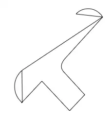

Serial Version: 

Any help is appreciated.
Sincerely,