Arsure-Arsurette | |
|---|---|
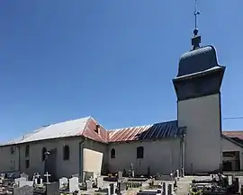 The church in Arsure-Arsurette | |
Location of Arsure-Arsurette | |
 Arsure-Arsurette 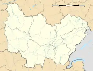 Arsure-Arsurette | |
| Coordinates: 46°43′24″N 6°05′00″E / 46.7233°N 6.0833°E | |
| Country | France |
| Region | Bourgogne-Franche-Comté |
| Department | Jura |
| Arrondissement | Lons-le-Saunier |
| Canton | Saint-Laurent-en-Grandvaux |
| Government | |
| • Mayor (2020–2026) | Catherine Rousset[1] |
| Area 1 | 12.56 km2 (4.85 sq mi) |
| Population | 99 |
| • Density | 7.9/km2 (20/sq mi) |
| Time zone | UTC+01:00 (CET) |
| • Summer (DST) | UTC+02:00 (CEST) |
| INSEE/Postal code | 39020 /39250 |
| Elevation | 875–1,205 m (2,871–3,953 ft) |
| 1 French Land Register data, which excludes lakes, ponds, glaciers > 1 km2 (0.386 sq mi or 247 acres) and river estuaries. | |
Arsure-Arsurette (French pronunciation: [aʁsyʁ aʁsyʁɛt]) is a commune in the Jura department in the region of Bourgogne-Franche-Comté in eastern France.[3]
Population
| Year | Pop. | ±% p.a. |
|---|---|---|
| 1968 | 148 | — |
| 1975 | 127 | −2.16% |
| 1982 | 110 | −2.03% |
| 1990 | 99 | −1.31% |
| 1999 | 87 | −1.43% |
| 2009 | 91 | +0.45% |
| 2014 | 97 | +1.29% |
| 2020 | 100 | +0.51% |
| Source: INSEE[5] | ||
See also
References
- ↑ "Répertoire national des élus: les maires". data.gouv.fr, Plateforme ouverte des données publiques françaises (in French). 2 December 2020.
- ↑ "Populations légales 2021". The National Institute of Statistics and Economic Studies. 28 December 2023.
- ↑ INSEE commune file
- ↑ One or more of the preceding sentences incorporates text from a publication now in the public domain: Chisholm, Hugh, ed. (1911). "Arsure". Encyclopædia Britannica. Vol. 2 (11th ed.). Cambridge University Press. p. 657.
- ↑ Population en historique depuis 1968, INSEE
Wikimedia Commons has media related to Arsure-Arsurette.
This article is issued from Wikipedia. The text is licensed under Creative Commons - Attribution - Sharealike. Additional terms may apply for the media files.