| At-Bashy | |
|---|---|
 | |
 | |
| Native name | Ат-Башы (Kyrgyz) |
| Location | |
| Country | Kyrgyzstan |
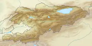
| Region | Naryn Region |
| District | At-Bashy District |
| Physical characteristics | |
| Source | confluence of Ulan and Jangy-Jer |
| • coordinates | 41°19′15″N 76°40′00″E / 41.32083°N 76.66667°E |
| • elevation | 2,837 m (9,308 ft) |
| Mouth | Naryn |
• coordinates | 41°22′20″N 75°35′55″E / 41.37222°N 75.59861°E |
• elevation | 1,807 m (5,928 ft) |
| Length | 180 km (110 mi) |
| Basin size | 5,540 km2 (2,140 sq mi) |
| Basin features | |
| Progression | Naryn→ Syr Darya→ North Aral Sea |
The At-Bashy (Kyrgyz: Ат-Башы) is a left tributary of the Naryn in Naryn Region of Kyrgyzstan. The river is formed at the north slope of Jangy-Jer Range by confluence of the rivers Ulan and Jangy-Jer. It flows into the Naryn near Dostuk. It is 180 kilometres (110 mi) long, and has a drainage basin of 5,540 square kilometres (2,140 sq mi).[1] Average altitude - 3,060 m, annual average flow rate - 33.1 m³/s, and average specific discharge - 5.98 L/s•km2.[2] Settlements located along the banks of the At-Bashy include: At-Bashy, Bash-Kayyngdy, Birinchi May and Taldy-Suu.[1]
References
- 1 2 "Атбашы" [Atbashy] (PDF). Кыргызстандын Географиясы [Geography of Kyrgyzstan] (in Kyrgyz). Bishkek. 2004. pp. 182–183.
{{cite encyclopedia}}: CS1 maint: location missing publisher (link) - ↑ Hydrological Characteristics of Naryn River and its tributaries (in Russian)
This article is issued from Wikipedia. The text is licensed under Creative Commons - Attribution - Sharealike. Additional terms may apply for the media files.