At Samat
อาจสามารถ | |
|---|---|
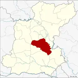 District location in Roi Et province | |
| Coordinates: 15°50′37″N 103°52′44″E / 15.84361°N 103.87889°E | |
| Country | Thailand |
| Province | Roi Et |
| Seat | At Samat |
| Area | |
| • Total | 454.4 km2 (175.4 sq mi) |
| Population (2015) | |
| • Total | 74,333 |
| • Density | 164.4/km2 (426/sq mi) |
| Time zone | UTC+7 (ICT) |
| Postal code | 45160 |
| Geocode | 4514 |
At Samat (Thai: อาจสามารถ, pronounced [ʔàːt sǎː.mâːt]) is a district (amphoe) of Roi Et province, Thailand.
เมืองไทย
The district is in central Roi Et Province. Neighboring districts are (from the north clockwise): Thawat Buri, Thung Khao Luang, Selaphum, Phanom Phrai, Suwannaphum, Mueang Suang, Chaturaphak Phiman (at a single point) and Mueang Roi Et.
History
The district was created in 1897, at first named Sa But (สระบุศย์). In 1913 it was renamed At Samat.[1]
In January 2006 Prime Minister Thaksin Shinawatra chose At Samat as the model district for his poverty eradication program. He visited the district and led a five-day workshop. The event was shown as a reality TV show named Backstage: The Prime Minister.
Administration
Central administration
The At Samat District is divided into 10 sub-districts (tambons), which are further subdivided into 139 administrative villages (mubans).
| No. | Name | Thai | Villages | Pop.[2] |
|---|---|---|---|---|
| 1. | At Samat | อาจสามารถ | 17 | 10,963 |
| 2. | Phon Mueang | โพนเมือง | 17 | 9,191 |
| 3. | Ban Chaeng | บ้านแจ้ง | 9 | 5,540 |
| 4. | Nom | หน่อม | 13 | 6,904 |
| 5. | Nong Muen Than | หนองหมื่นถ่าน | 17 | 9,192 |
| 6. | Nong Kham | หนองขาม | 19 | 10,318 |
| 7. | Hora | โหรา | 14 | 7,682 |
| 8. | Nong Bua | หนองบัว | 10 | 4,232 |
| 9. | Khilek | ขี้เหล็ก | 12 | 4,717 |
| 10. | Ban Du | บ้านดู่ | 11 | 5,594 |
Local administration
There are two sub-district municipalities (thesaban tambons) in the district:
- At Samat (Thai: เทศบาลตำบลอาจสามารถ) consisting of parts of sub-district At Samat.
- Phon Mueang (Thai: เทศบาลตำบลโพนเมือง) consisting of sub-district Phon Mueang.
There are nine sub-district administrative organizations (SAO) in the district:
- At Samat (Thai: องค์การบริหารส่วนตำบลอาจสามารถ) consisting of parts of sub-district At Samat.
- Ban Chaeng (Thai: องค์การบริหารส่วนตำบลบ้านแจ้ง) consisting of sub-district Ban Chaeng.
- Nom (Thai: องค์การบริหารส่วนตำบลหน่อม) consisting of sub-district Nom.
- Nong Muen Than (Thai: องค์การบริหารส่วนตำบลหนองหมื่นถ่าน) consisting of sub-district Nong Muen Than.
- Nong Kham (Thai: องค์การบริหารส่วนตำบลหนองขาม) consisting of sub-district Nong Kham.
- Hora (Thai: องค์การบริหารส่วนตำบลโหรา) consisting of sub-district Hora.
- Nong Bua (Thai: องค์การบริหารส่วนตำบลหนองบัว) consisting of sub-district Nong Bua.
- Khilek (Thai: องค์การบริหารส่วนตำบลขี้เหล็ก) consisting of sub-district Khilek.
- Ban Du (Thai: องค์การบริหารส่วนตำบลบ้านดู่) consisting of sub-district Ban Du.
References
- ↑ แจ้งความกระทรวงมหาดไทย เรื่อง เปลี่ยนนามอำเภอ (PDF). Royal Gazette (in Thai). 30 (ง): 1619–1620. October 19, 1913. Archived from the original (PDF) on May 10, 2012.
- ↑ "Population statistics 2015" (in Thai). Department of Provincial Administration. Retrieved 2016-03-24.
External links
- Amphoe (Thai)