Balagny-sur-Thérain | |
|---|---|
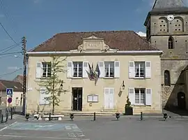 Town hall | |
 Coat of arms | |
Location of Balagny-sur-Thérain | |
 Balagny-sur-Thérain 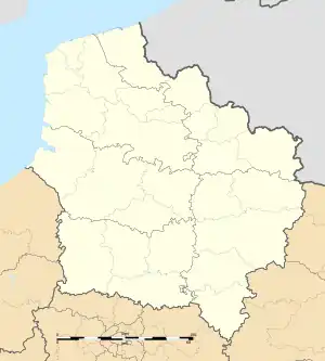 Balagny-sur-Thérain | |
| Coordinates: 49°17′46″N 2°20′14″E / 49.2961°N 2.3372°E | |
| Country | France |
| Region | Hauts-de-France |
| Department | Oise |
| Arrondissement | Senlis |
| Canton | Montataire |
| Government | |
| • Mayor (2020–2026) | Philippe Maréchal[1] |
| Area 1 | 6.8 km2 (2.6 sq mi) |
| Population | 1,649 |
| • Density | 240/km2 (630/sq mi) |
| Time zone | UTC+01:00 (CET) |
| • Summer (DST) | UTC+02:00 (CEST) |
| INSEE/Postal code | 60044 /60250 |
| Elevation | 33–116 m (108–381 ft) (avg. 39 m or 128 ft) |
| 1 French Land Register data, which excludes lakes, ponds, glaciers > 1 km2 (0.386 sq mi or 247 acres) and river estuaries. | |
Balagny-sur-Thérain (French pronunciation: [balaɲi syʁ teʁɛ̃], literally Balagny on Thérain) is a commune in the Oise department in northern France. Balagny-Saint-Épin station has rail connections to Beauvais and Creil.
Population
| Year | Pop. | ±% p.a. |
|---|---|---|
| 1968 | 1,332 | — |
| 1975 | 1,393 | +0.64% |
| 1982 | 1,299 | −0.99% |
| 1990 | 1,487 | +1.70% |
| 1999 | 1,418 | −0.53% |
| 2009 | 1,398 | −0.14% |
| 2014 | 1,604 | +2.79% |
| 2020 | 1,671 | +0.68% |
| Source: INSEE[3] | ||
See also
References
- ↑ "Répertoire national des élus: les maires" (in French). data.gouv.fr, Plateforme ouverte des données publiques françaises. 13 September 2022.
- ↑ "Populations légales 2021". The National Institute of Statistics and Economic Studies. 28 December 2023.
- ↑ Population en historique depuis 1968, INSEE
Wikimedia Commons has media related to Balagny-sur-Thérain.
This article is issued from Wikipedia. The text is licensed under Creative Commons - Attribution - Sharealike. Additional terms may apply for the media files.