Bozouls | |
|---|---|
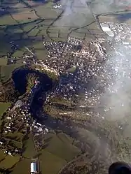 An aerial view of Bozouls | |
.svg.png.webp) Coat of arms | |
Location of Bozouls | |
 Bozouls 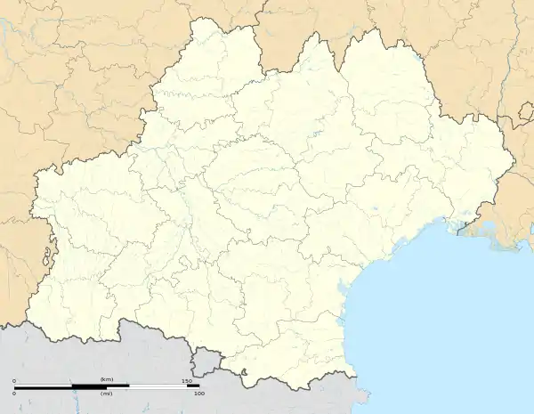 Bozouls | |
| Coordinates: 44°28′17″N 2°43′17″E / 44.4714°N 2.7214°E | |
| Country | France |
| Region | Occitania |
| Department | Aveyron |
| Arrondissement | Rodez |
| Canton | Causse-Comtal |
| Government | |
| • Mayor (2020–2026) | Jean-Luc Calmelly[1] |
| Area 1 | 69.69 km2 (26.91 sq mi) |
| Population | 2,978 |
| • Density | 43/km2 (110/sq mi) |
| Time zone | UTC+01:00 (CET) |
| • Summer (DST) | UTC+02:00 (CEST) |
| INSEE/Postal code | 12033 /12340 |
| Elevation | 355–711 m (1,165–2,333 ft) (avg. 640 m or 2,100 ft) |
| 1 French Land Register data, which excludes lakes, ponds, glaciers > 1 km2 (0.386 sq mi or 247 acres) and river estuaries. | |
Bozouls (French pronunciation: [bozul]; Occitan: Boason) is a commune in the Aveyron department in southern France.
It is located on Route Maquis de Jean Pierre (D20) thirty minutes from Rodez, one hour from the Gorges du Tarn, two hours northeast of Toulouse, and six and a half hours due south of Paris.
It sits on the edge of a gorge created by the river Dourdou de Conques.[3]
Population
| Year | Pop. | ±% p.a. |
|---|---|---|
| 1968 | 1,701 | — |
| 1975 | 1,817 | +0.95% |
| 1982 | 2,032 | +1.61% |
| 1990 | 2,060 | +0.17% |
| 1999 | 2,329 | +1.37% |
| 2007 | 2,759 | +2.14% |
| 2012 | 2,742 | −0.12% |
| 2017 | 2,871 | +0.92% |
| Source: INSEE[4] | ||
Notable people and residents in Bozouls
- Richard Belzer - American actor
See also
References
- ↑ "Répertoire national des élus: les maires". data.gouv.fr, Plateforme ouverte des données publiques françaises (in French). 2 December 2020.
- ↑ "Populations légales 2021". The National Institute of Statistics and Economic Studies. 28 December 2023.
- ↑ "French Town Teeters on Edge of 'Hole'". The Weather Channel. Retrieved 13 June 2019.
- ↑ Population en historique depuis 1968, INSEE
External links
- Official Web site Archived 7 April 2020 at the Wayback Machine
Wikimedia Commons has media related to Bozouls.
This article is issued from Wikipedia. The text is licensed under Creative Commons - Attribution - Sharealike. Additional terms may apply for the media files.