Capens | |
|---|---|
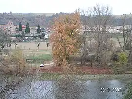 A general view of Capens | |
.svg.png.webp) Coat of arms | |
Location of Capens | |
 Capens 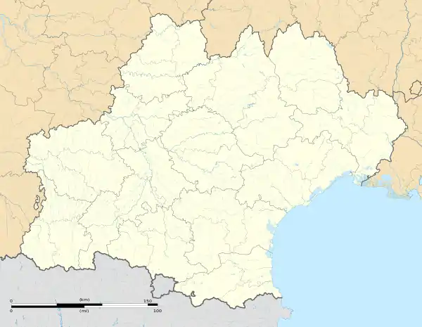 Capens | |
| Coordinates: 43°20′16″N 1°15′37″E / 43.3378°N 1.2603°E | |
| Country | France |
| Region | Occitania |
| Department | Haute-Garonne |
| Arrondissement | Muret |
| Canton | Auterive |
| Government | |
| • Mayor (2020–2026) | Richard Danes[1] |
| Area 1 | 6.77 km2 (2.61 sq mi) |
| Population | 664 |
| • Density | 98/km2 (250/sq mi) |
| Time zone | UTC+01:00 (CET) |
| • Summer (DST) | UTC+02:00 (CEST) |
| INSEE/Postal code | 31104 /31410 |
| Elevation | 174–290 m (571–951 ft) (avg. 200 m or 660 ft) |
| 1 French Land Register data, which excludes lakes, ponds, glaciers > 1 km2 (0.386 sq mi or 247 acres) and river estuaries. | |
Capens (French pronunciation: [kapɛ̃s]) is a commune in the Haute-Garonne department in southwestern France.
Geography
The village lies on the left banks of the Garonne river, which flows northeast through the middle of the commune.
The commune is bordered by five other communes: Noé to the north, Longages to the northwest, Carbonne to the west, Marquefave to the south, and finally by Montaut to the east.
Population
| Year | Pop. | ±% |
|---|---|---|
| 1962 | 229 | — |
| 1968 | 238 | +3.9% |
| 1975 | 247 | +3.8% |
| 1982 | 238 | −3.6% |
| 1990 | 253 | +6.3% |
| 1999 | 285 | +12.6% |
| 2008 | 483 | +69.5% |
| 2018 | 672 | +39.1% |
See also
References
- ↑ "Répertoire national des élus: les maires". data.gouv.fr, Plateforme ouverte des données publiques françaises (in French). 9 August 2021.
- ↑ "Populations légales 2021". The National Institute of Statistics and Economic Studies. 28 December 2023.
Wikimedia Commons has media related to Capens.
This article is issued from Wikipedia. The text is licensed under Creative Commons - Attribution - Sharealike. Additional terms may apply for the media files.