Chéry | |
|---|---|
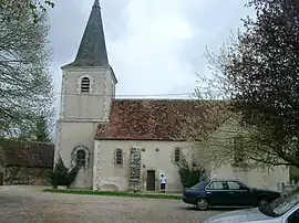 The church in Chéry | |
.svg.png.webp) Coat of arms | |
Location of Chéry | |
 Chéry 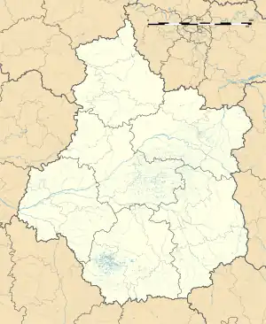 Chéry | |
| Coordinates: 47°07′15″N 2°02′50″E / 47.1208°N 2.0472°E | |
| Country | France |
| Region | Centre-Val de Loire |
| Department | Cher |
| Arrondissement | Vierzon |
| Canton | Mehun-sur-Yèvre |
| Intercommunality | CC Cœur de Berry |
| Government | |
| • Mayor (2020–2026) | Damien Prely[1] |
| Area 1 | 13.54 km2 (5.23 sq mi) |
| Population | 219 |
| • Density | 16/km2 (42/sq mi) |
| Time zone | UTC+01:00 (CET) |
| • Summer (DST) | UTC+02:00 (CEST) |
| INSEE/Postal code | 18064 /18120 |
| Elevation | 104–161 m (341–528 ft) (avg. 100 m or 330 ft) |
| 1 French Land Register data, which excludes lakes, ponds, glaciers > 1 km2 (0.386 sq mi or 247 acres) and river estuaries. | |
Chéry (French pronunciation: [ʃeʁi]) is a commune in the Cher department in the Centre-Val de Loire region of France.
Geography
An area of farming and forestry, comprising the main village and a hamlet, situated in the valley of the river Arnon some 8 miles (13 km) south of Vierzon, at the junction of the D75, D165 and the D68 roads.
Population
| Year | Pop. | ±% |
|---|---|---|
| 1962 | 299 | — |
| 1968 | 306 | +2.3% |
| 1975 | 276 | −9.8% |
| 1982 | 266 | −3.6% |
| 1990 | 268 | +0.8% |
| 1999 | 236 | −11.9% |
| 2008 | 219 | −7.2% |
Sights
- The church of St. Didier, dating from the sixteenth century.
See also
References
- ↑ "Répertoire national des élus: les maires". data.gouv.fr, Plateforme ouverte des données publiques françaises (in French). 9 August 2021.
- ↑ "Populations légales 2021". The National Institute of Statistics and Economic Studies. 28 December 2023.
Wikimedia Commons has media related to Chéry.
This article is issued from Wikipedia. The text is licensed under Creative Commons - Attribution - Sharealike. Additional terms may apply for the media files.