Collonges
| |
|---|---|
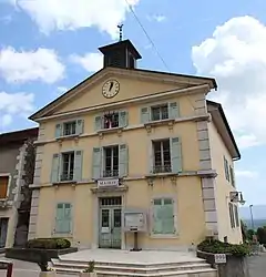 Collonges Town Hall | |
.svg.png.webp) Coat of arms | |
Location of Collonges | |
 Collonges 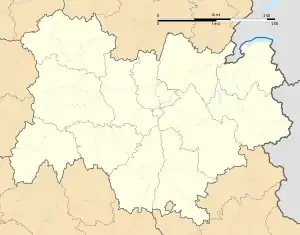 Collonges | |
| Coordinates: 46°08′21″N 5°54′18″E / 46.1392°N 5.905°E | |
| Country | France |
| Region | Auvergne-Rhône-Alpes |
| Department | Ain |
| Arrondissement | Gex |
| Canton | Thoiry |
| Intercommunality | CA Pays de Gex |
| Government | |
| • Mayor (2020–2026) | Lionel Perreal[1] |
| Area 1 | 16.25 km2 (6.27 sq mi) |
| Population | 2,249 |
| • Density | 140/km2 (360/sq mi) |
| Time zone | UTC+01:00 (CET) |
| • Summer (DST) | UTC+02:00 (CEST) |
| INSEE/Postal code | 01109 /01550 |
| Elevation | 329–1,621 m (1,079–5,318 ft) (avg. 500 m or 1,600 ft) |
| 1 French Land Register data, which excludes lakes, ponds, glaciers > 1 km2 (0.386 sq mi or 247 acres) and river estuaries. | |
Collonges (French pronunciation: [kɔlɔ̃ʒ]; Arpitan: Colonges) is a commune in the Ain department in the Auvergne-Rhône-Alpes region in Eastern France. Collonges is located on the border with the Haute-Savoie department, just northeast of Fort l'Écluse in Léaz, Ain. It is also situated 20 km (12.4 mi) southwest of Geneva, Switzerland.[3][4]
Demographics
| Year | Pop. | ±% p.a. |
|---|---|---|
| 1968 | 901 | — |
| 1975 | 966 | +1.00% |
| 1982 | 926 | −0.60% |
| 1990 | 1,000 | +0.97% |
| 1999 | 1,106 | +1.13% |
| 2009 | 1,821 | +5.11% |
| 2014 | 2,163 | +3.50% |
| 2020 | 2,230 | +0.51% |
| Source: INSEE[5] | ||
See also
References
- ↑ "Répertoire national des élus: les maires" (in French). data.gouv.fr, Plateforme ouverte des données publiques françaises. 13 September 2022.
- ↑ "Populations légales 2021". The National Institute of Statistics and Economic Studies. 28 December 2023.
- ↑ Collonges Fort L'Ecluse Archived 2008-09-17 at the Wayback Machine
- ↑ Inheritance museums and monuments: Fort l'Ecluse Archived 2008-07-20 at the Wayback Machine
- ↑ Population en historique depuis 1968, INSEE
Wikimedia Commons has media related to Collonges, Ain.
This article is issued from Wikipedia. The text is licensed under Creative Commons - Attribution - Sharealike. Additional terms may apply for the media files.