Division No. 14 | |
|---|---|
| Country | Canada |
| Province | Alberta |
| Area | |
| • Total | 26,965 km2 (10,411 sq mi) |
| As of 2011 | |
| Population (2011)[1] | |
| • Total | 28,584 |
| • Density | 1.1/km2 (2.7/sq mi) |
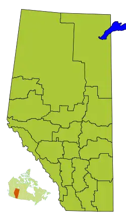
Division No. 14 is a census division in Alberta, Canada. The majority of the division is located in the western portion of central Alberta, while the westernmost portion of the division is located within Alberta's Rockies. The division's largest urban community is the Town of Hinton.
Census subdivisions
The following census subdivisions (municipalities or municipal equivalents) are located within Alberta's Division No. 14.[2][3]
- Towns
- Municipal districts
- Improvement districts
- Improvement District No. 25 (Willmore Wilderness Park)
Demographics
In the 2021 Census of Population conducted by Statistics Canada, Division No. 14 had a population of 28,617 living in 11,552 of its 13,032 total private dwellings, a change of -2.3% from its 2016 population of 29,291. With a land area of 26,902.83 km2 (10,387.24 sq mi), it had a population density of 1.1/km2 (2.8/sq mi) in 2021.[4]
See also
References
- 1 2 "Population and dwelling counts, for Canada, provinces and territories, and census divisions, 2011 and 2006 censuses (Alberta)". Statistics Canada. February 8, 2012. Retrieved February 16, 2012.
- ↑ "2006 Community Profiles, Geographic hierarchy – Division No. 14 (Census division)". Statistics Canada. December 7, 2010. Retrieved August 30, 2011.
- ↑ "2022 Municipal Codes" (PDF). Alberta Municipal Affairs. January 5, 2022. Retrieved January 21, 2022.
- ↑ "Population and dwelling counts: Canada and census divisions". Statistics Canada. February 9, 2022. Retrieved April 2, 2022.
Places adjacent to Division No. 14, Alberta | ||||||||||||||||
|---|---|---|---|---|---|---|---|---|---|---|---|---|---|---|---|---|
| ||||||||||||||||
Subdivisions of Alberta | |
|---|---|
| Subdivisions | |
| Communities | |
| Cities and urban service areas | |
| Census divisions | |
| |
This article is issued from Wikipedia. The text is licensed under Creative Commons - Attribution - Sharealike. Additional terms may apply for the media files.