Dlžín | |
|---|---|
Municipality | |
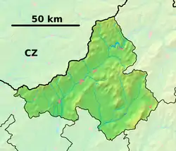 Dlžín Location of Dlžín in the Trenčín Region 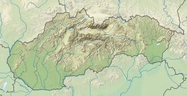 Dlžín Location of Dlžín in Slovakia | |
| Coordinates: 48°49′N 18°31′E / 48.817°N 18.517°E | |
| Country | |
| Region | Trenčín |
| District | Prievidza |
| First mentioned | 1272 |
| Area | |
| • Total | 6.653 km2 (2.569 sq mi) |
| Elevation | 396 m (1,299 ft) |
| Population | |
| • Total | 187 |
| • Density | 28/km2 (73/sq mi) |
| Postal code | 972 26 |
| Area code | 421-46 |
| Car plate | PD |
Dlžín (Hungarian: Delzsény) is a village and municipality in Prievidza District in the Trenčín Region of western Slovakia.
History
In historical records the village was first mentioned in 1272.
Geography
The municipality lies at an altitude of 396 metres and covers an area of 6.653 km². It has a population of about 187 people.
Genealogical resources
The records for genealogical research are available at the state archive "Statny Archiv in Nitra, Slovakia"
- Roman Catholic church records (births/marriages/deaths): 1790-1909 (parish B)
See also
External links
- https://web.archive.org/web/20071116010355/http://www.statistics.sk/mosmis/eng/run.html
- Surnames of living people in Dlzin
This article is issued from Wikipedia. The text is licensed under Creative Commons - Attribution - Sharealike. Additional terms may apply for the media files.