Dolní Město | |
|---|---|
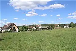 View of Dolní Město | |
 Flag  Coat of arms | |
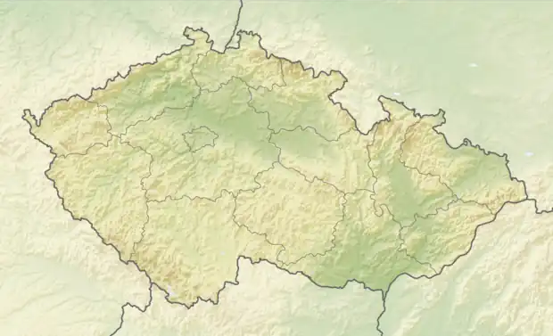 Dolní Město Location in the Czech Republic | |
| Coordinates: 49°37′40″N 15°22′56″E / 49.62778°N 15.38222°E | |
| Country | |
| Region | Vysočina |
| District | Havlíčkův Brod |
| First mentioned | 1386 |
| Area | |
| • Total | 18.81 km2 (7.26 sq mi) |
| Elevation | 440 m (1,440 ft) |
| Population (2023-01-01)[1] | |
| • Total | 939 |
| • Density | 50/km2 (130/sq mi) |
| Time zone | UTC+1 (CET) |
| • Summer (DST) | UTC+2 (CEST) |
| Postal codes | 582 33, 582 91, 584 01 |
| Website | www |
Dolní Město (Czech pronunciation: [ˈdolɲiː ˈmɲɛsto]) is a municipality and village in Havlíčkův Brod District in the Vysočina Region of the Czech Republic. It has about 900 inhabitants.
Dolní Město lies approximately 15 kilometres (9 mi) west of Havlíčkův Brod, 30 km (19 mi) north-west of Jihlava, and 86 km (53 mi) south-east of Prague.
Administrative parts
Villages and hamlets of Dobrá Voda Lipnická, Loukov, Meziklasí, Rejčkov and Smrčensko are administrative parts of Dolní Město.
References
Wikimedia Commons has media related to Dolní Město.
This article is issued from Wikipedia. The text is licensed under Creative Commons - Attribution - Sharealike. Additional terms may apply for the media files.