23°55′22″N 120°24′33″E / 23.922875°N 120.409073°E
Erlin Township
二林鎮 Erhlin | |
|---|---|
 | |
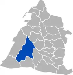 Erlin Township in Changhua County | |
| Location | Changhua County, Taiwan |
| Area | |
| • Total | 93 km2 (36 sq mi) |
| Population (January 2023) | |
| • Total | 48,379 |
| • Density | 520/km2 (1,300/sq mi) |
| Website | town |
Erlin Township (Chinese: 二林鎮; pinyin: Èrlín Zhèn; Pe̍h-ōe-jī: Jī-lîm-tìn/Gī-lîm-tìn) is an urban township in Changhua County, Taiwan.[1]
Geography
With an area of 92.8578 square kilometers, it is the largest township in Changhua County. As of January 2023, its population was 48,379, including 24,774 males and 23,605 females.[2]
History
During the Dutch period, the area was under the administrative region of Favorlang (modern-day Huwei, Yunlin). Present-day Erlin was probably at or near Gierim, "one of the primary centers for Sino-aboriginal trade and a favorite haunt of pirates and smugglers."[3]
Administrative divisions
Fengtian, Donghe, Nanguang, Xiping, Beiping, Zhongxi, Guangxing, Xiangtian, Waizhu, Xinghua, Dongxing, Houcuo, Dingcuo, Zhaojia, Zhenxing, Wanxing, Yongxing, Xizhuang, Meifang, Hualun, Wange, Dongshi, Dayong, Yuandou, Xidou, Donghua and Fufeng Village.
Tourist attractions
- Renhe Temple
Transportation

Bus station in the township is Erlin Bus Station of Yuanlin Bus.
Notable natives
- Liu Wen-hsiung, Member of the Legislative Yuan (1990)
- Liao Yung-lai, Member of the Legislative Yuan (1993–1996), Taichung County magistrate (1997–2001)
References
- ↑ "彰化縣政府全球資訊網". January 2011.
- ↑ 統計資料 | 一月 | 表四 [Statistics|January|Table 4]. accounting.chcg.gov.tw (in Chinese). Changhua County Government. 10 February 2017. Retrieved 11 February 2017.
- ↑ Andrade, Tonio (2005). "Chapter 7: The Challenges of a Chinese Frontier". How Taiwan Became Chinese: Dutch, Spanish, and Han Colonization in the Seventeenth Century. Columbia University Press. §13.
External links
- Official website
 (in Chinese)
Cities and townships of Changhua County | ||
|---|---|---|
| Cities | 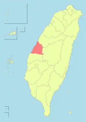 | |
| Urban townships | ||
| Rural townships | ||