Fère-Champenoise | |
|---|---|
.JPG.webp) Town hall | |
 Coat of arms | |
Location of Fère-Champenoise | |
 Fère-Champenoise 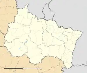 Fère-Champenoise | |
| Coordinates: 48°45′15″N 3°59′29″E / 48.7542°N 3.9914°E | |
| Country | France |
| Region | Grand Est |
| Department | Marne |
| Arrondissement | Épernay |
| Canton | Vertus-Plaine Champenoise |
| Intercommunality | Sud Marnais |
| Government | |
| • Mayor (2020–2026) | Gérard Gorisse[1] |
| Area 1 | 65.89 km2 (25.44 sq mi) |
| Population | 2,171 |
| • Density | 33/km2 (85/sq mi) |
| Time zone | UTC+01:00 (CET) |
| • Summer (DST) | UTC+02:00 (CEST) |
| INSEE/Postal code | 51248 /51230 |
| 1 French Land Register data, which excludes lakes, ponds, glaciers > 1 km2 (0.386 sq mi or 247 acres) and river estuaries. | |
Fère-Champenoise (French pronunciation: [fɛʁ ʃɑ̃pnwaz]) is a commune in the Marne department in north-eastern France. It was the site of the Battle of Fère-Champenoise in March 1814.
Population
| Year | Pop. | ±% p.a. |
|---|---|---|
| 1968 | 2,252 | — |
| 1975 | 2,544 | +1.76% |
| 1982 | 2,518 | −0.15% |
| 1990 | 2,362 | −0.80% |
| 1999 | 2,293 | −0.33% |
| 2007 | 2,310 | +0.09% |
| 2012 | 2,285 | −0.22% |
| 2017 | 2,145 | −1.26% |
| Source: INSEE[3] | ||
See also
- Communes of the Marne department
- Fershampenuaz, a village in Russia, named after the 1814 battle.
References
- ↑ "Répertoire national des élus: les maires" (in French). data.gouv.fr, Plateforme ouverte des données publiques françaises. 13 September 2022.
- ↑ "Populations légales 2020". The National Institute of Statistics and Economic Studies. 29 December 2022.
- ↑ Population en historique depuis 1968, INSEE
Wikimedia Commons has media related to Fère-Champenoise.
This article is issued from Wikipedia. The text is licensed under Creative Commons - Attribution - Sharealike. Additional terms may apply for the media files.