Friendship, Ohio | |
|---|---|
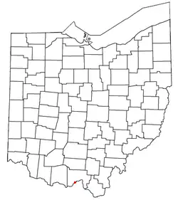 Location of Friendship, Ohio | |
| Coordinates: 38°41′52″N 83°05′38″W / 38.69778°N 83.09389°W | |
| Country | United States |
| State | Ohio |
| County | Scioto |
| Township | Nile |
| Population | |
| • Total | 343 |
| Time zone | UTC-5 (Eastern (EST)) |
| • Summer (DST) | UTC-4 (EDT) |
| ZIP code | 45630 |
| Area code(s) | 740, 220 |
Friendship is a census-designated place in western Nile Township, Scioto County, Ohio, United States.[2] As of the 2020 census it had a population of 343. It has a post office with the ZIP code 45630.[3] It lies along U.S. Route 52.
The citizens of Friendship are served by the Nile Township Volunteer Fire Department and the Washington-Nile Local School District (Portsmouth West High School).
Notable person
- Al Bridwell, former Major League Baseball player
References
- ↑ "Friendship CPD, Ohio - Census Bureau Profile". United States Census Bureau. Retrieved August 19, 2023.
- ↑ U.S. Geological Survey Geographic Names Information System: Friendship, Ohio
- ↑ USPS – Cities by ZIP Code
External links
Municipalities and communities of Scioto County, Ohio, United States | ||
|---|---|---|
| City | 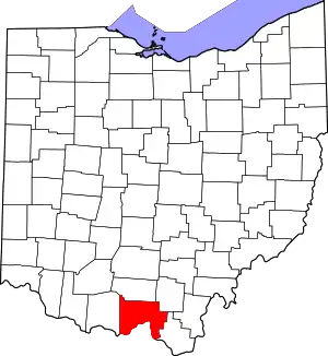 Map of Ohio highlighting Scioto County | |
| Villages | ||
| Townships | ||
| CDPs | ||
| Unincorporated communities | ||
| Footnotes | ‡This populated place also has portions in an adjacent county or counties | |
This article is issued from Wikipedia. The text is licensed under Creative Commons - Attribution - Sharealike. Additional terms may apply for the media files.