| Gabas | |
|---|---|
 | |
  | |
| Location | |
| Country | France |
| Physical characteristics | |
| Source | |
| • location | Plateau of Ger |
| Mouth | |
• location | Adour |
• coordinates | 43°45′41″N 0°42′9″W / 43.76139°N 0.70250°W |
| Length | 117 km (73 mi) |
| Basin features | |
| Progression | Adour→ Atlantic Ocean |
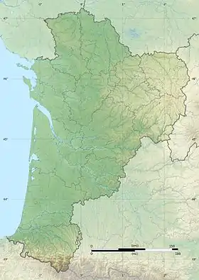
The Gabas (French pronunciation: [ɡabas]; Occitan: Gabàs) is a left tributary of the Adour, in the Landes, in the Southwest of France. It is 116.7 km (72.5 mi) long.[1]
Name
The name Gabas is derived from the French gave (Gascon: 'gabe'), which in the Pyrenees generically describes a small or large watercourse. The river was known as the fluvius gavasensis in 982.[2]
A tributary of the Léez is named the Gabassot, a hypocoristic of Gabas.
Geography
The Gabas rises in the plateau of Ger in the north of Lourdes, as the union of the Gabastou and the Honrède. It flows north-west like the neighboring rivers: the Luy, the Uzan and the Ousse.
The Gabas crosses the Tursan, in the Landes. It flows into the Adour in Toulouzette, downstream from Saint-Sever.
A dam of 20 million cubic metres (16,000 acre⋅ft) was built in its upper course to regulate the lowest water level.
Main tributaries
- (R) the Bayle from Lourenties
- (R) the Bas, from Geaune
- (R) the Lescoû, from Saint-Loubouer
- (L) the Petit Bas, from Pimbo
- (L) the Laudon, from Hagetmau
References
- ↑ Sandre. "Fiche cours d'eau - Le Gabas (Q13-0400)".
- ↑ cartulary of Saint-Sever.