Gnadenwald | |
|---|---|
 | |
 Coat of arms | |
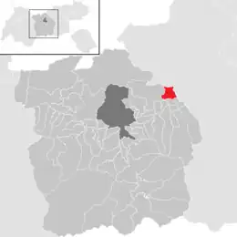 Location in the district | |
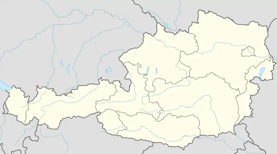 Gnadenwald Location within Austria | |
| Coordinates: 47°19′20″N 11°34′37″E / 47.32222°N 11.57694°E | |
| Country | Austria |
| State | Tyrol |
| District | Innsbruck Land |
| Government | |
| • Mayor | Günter Strasser (Gemeinschaftsliste Gnadenwald) |
| Area | |
| • Total | 11.5 km2 (4.4 sq mi) |
| Elevation | 879 m (2,884 ft) |
| Population (2018-01-01)[2] | |
| • Total | 826 |
| • Density | 72/km2 (190/sq mi) |
| Time zone | UTC+1 (CET) |
| • Summer (DST) | UTC+2 (CEST) |
| Postal code | 6069 |
| Area code | 05223 |
| Vehicle registration | IL |
| Website | www.gnadenwald.tirol.gv.at |
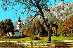
Gnadenwald is a municipality in the eastern part of the district Innsbruck country. The village consists of several hamlets and the church villages: St. Martin and St. Michael.
Population
| Year | Pop. | ±% |
|---|---|---|
| 1869 | 301 | — |
| 1880 | 288 | −4.3% |
| 1890 | 282 | −2.1% |
| 1900 | 266 | −5.7% |
| 1910 | 266 | +0.0% |
| 1923 | 284 | +6.8% |
| 1934 | 273 | −3.9% |
| 1939 | 258 | −5.5% |
| 1951 | 359 | +39.1% |
| 1961 | 309 | −13.9% |
| 1971 | 350 | +13.3% |
| 1981 | 409 | +16.9% |
| 1991 | 551 | +34.7% |
| 2001 | 605 | +9.8% |
| 2011 | 713 | +17.9% |
| 2015 | 772 | +8.3% |
Personalities
Gnadenwald was the birthplace of the Tyrolean nationalist leader and rebel Josef Speckbacher
References
- ↑ "Dauersiedlungsraum der Gemeinden Politischen Bezirke und Bundesländer - Gebietsstand 1.1.2018". Statistics Austria. Retrieved 10 March 2019.
- ↑ "Einwohnerzahl 1.1.2018 nach Gemeinden mit Status, Gebietsstand 1.1.2018". Statistics Austria. Retrieved 9 March 2019.
External links
- Town history (German)
- Municipality Gnadenwald: Official website of the municipality in the Hall-Wattens region
Wikimedia Commons has media related to Gnadenwald.
This article is issued from Wikipedia. The text is licensed under Creative Commons - Attribution - Sharealike. Additional terms may apply for the media files.