Goobertown, Arkansas | |
|---|---|
 Goobertown, Arkansas  Goobertown, Arkansas | |
| Coordinates: 35°57′05″N 90°34′32″W / 35.95139°N 90.57556°W | |
| Country | United States |
| State | Arkansas |
| County | Craighead |
| Elevation | 302 ft (92 m) |
| Time zone | UTC-6 (Central (CST)) |
| • Summer (DST) | UTC-5 (CDT) |
| Area code | 870 |
| GNIS feature ID | 77034[1] |
Goobertown is an unincorporated community in Craighead County, Arkansas, United States. Goobertown is located on U.S. Route 49, 10.4 miles (16.7 km) northeast of Jonesboro.[2]
References
- ↑ "Goobertown". Geographic Names Information System. United States Geological Survey, United States Department of the Interior.
- ↑ Craighead County, Arkansas General Highway Map (PDF) (Map). Arkansas State Highway and Transportation Department. 2009. Archived from the original (PDF) on September 2, 2011. Retrieved September 19, 2012.
Municipalities and communities of Craighead County, Arkansas, United States | ||
|---|---|---|
| Cities | 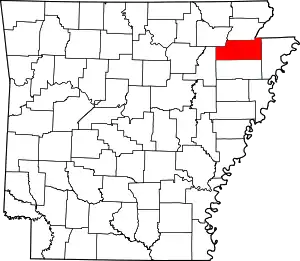 Map of Arkansas highlighting Craighead County | |
| Towns | ||
| CDP | ||
| Other unincorporated communities | ||
| Ghost town | ||
This article is issued from Wikipedia. The text is licensed under Creative Commons - Attribution - Sharealike. Additional terms may apply for the media files.