38°53′48″N 120°54′46″W / 38.89667°N 120.91278°W
Greenwood | |
|---|---|
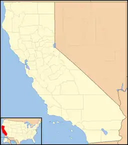 Greenwood Location in California  Greenwood Greenwood (the United States) | |
| Coordinates: 38°53′48″N 120°54′46″W / 38.89667°N 120.91278°W | |
| Country | United States |
| State | California |
| County | El Dorado County |
| Elevation | 1,608 ft (490 m) |
| Population (2010) | |
| • Total | 1,007 |
| Reference no. | 521 |
Greenwood (formerly, Long Valley, Green Valley, Lewisville, and Louisville)[2] is an unincorporated community in El Dorado County, California.[1] It is located 4 miles (6.4 km) west of Georgetown,[2] at an elevation of 1608 feet (490 m).[1]
The place was originally called Long Valley, then Green Valley, then Lewisville, and finally Greenwood, in honor of John Greenwood who set up a trading post there in 1848.[2] The Louisville post office operated from 1852 to 1852, when it was moved and renamed to Greenwood.[2] A schoolhouse operated at Greenwood until 1954, and since then local schoolchildren have been bused to Cool, although the school remains standing.[3]
The community is now registered as California Historical Landmark #521.[4]
References
- 1 2 3 U.S. Geological Survey Geographic Names Information System: Greenwood, El Dorado County, California
- 1 2 3 4 Durham, David L. (1998). California's Geographic Names: A Gazetteer of Historic and Modern Names of the State. Clovis, Calif.: Word Dancer Press. p. 494. ISBN 1-884995-14-4.
- ↑ King, James (July 23, 2017). "The Greenwood School House". HMDb.org. Historical Marker Database. Retrieved December 25, 2023.
- ↑ "Greenwood". Office of Historic Preservation, California State Parks. Retrieved October 7, 2012.
Municipalities and communities of El Dorado County, California, United States | ||
|---|---|---|
| Cities |  El Dorado County map | |
| CDPs | ||
| Unincorporated communities |
| |
| Former settlements | ||
| Footnotes | ‡This CDP also has portions in an adjacent county or counties | |