Horná Štubňa | |
|---|---|
Village | |
 Horná Štubňa | |
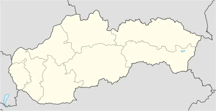 Horná Štubňa Location of Horná Štubňa in Slovakia | |
| Coordinates: 48°49′30″N 18°53′03″E / 48.82493°N 18.88423°E | |
| Country | Slovakia |
| Region | Žilina |
| District | Turčianske Teplice |
| First mentioned | 1390 |
| Area | |
| • Total | 31.38[1] km2 (12.12[1] sq mi) |
| Elevation | 624[2] m (2,047[2] ft) |
| Population (2021) | |
| • Total | 1,621[3] |
| Postal code | 038 46[2] |
| Area code | +421 43[2] |
| Car plate | TR |
| Website | www.hornastubna.sk |
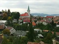
Horná Štubňa (German: Oberstuben; Hungarian: Felsőstubnya) is a village and municipality in Turčianske Teplice District in the Žilina Region of northern central Slovakia.
History
In historical records the village was first mentioned in 1390. The village belonged to a German language island. The German population was expelled in 1945.
Geography
The municipality lies at an altitude of 627 metres and covers an area of 31.388 km2. It has a population of about 1,610 people.
Famous people
- Emília Vášáryová, actress
Wikimedia Commons has media related to Horná Štubňa.
Genealogical resources
The records for genealogical research are available at the state archive "Statny Archiv in Bytca, Slovakia"
- Roman Catholic church records (births/marriages/deaths): 1737-1919 (parish A)
- Lutheran church records (births/marriages/deaths): 1820-1923 (parish B)
See also
References
- 1 2 "Hustota obyvateľstva - obce [om7014rr_ukaz: Rozloha (Štvorcový meter)]". www.statistics.sk (in Slovak). Statistical Office of the Slovak Republic. 2022-03-31. Retrieved 2022-03-31.
- 1 2 3 4 "Základná charakteristika". www.statistics.sk (in Slovak). Statistical Office of the Slovak Republic. 2015-04-17. Retrieved 2022-03-31.
- ↑ "Počet obyvateľov podľa pohlavia - obce (ročne)". www.statistics.sk (in Slovak). Statistical Office of the Slovak Republic. 2022-03-31. Retrieved 2022-03-31.
External links
Municipalities of Turčianske Teplice District | ||
|---|---|---|
This article is issued from Wikipedia. The text is licensed under Creative Commons - Attribution - Sharealike. Additional terms may apply for the media files.