Iabakoho | |
|---|---|
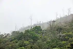 the Tsitongambarika forest. | |
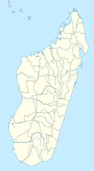 Iabakoho Location in Madagascar | |
| Coordinates: 24°36′S 47°13′E / 24.600°S 47.217°E | |
| Country | |
| Region | Anosy |
| District | Taolanaro |
| Elevation | 40 m (130 ft) |
| Population (2001)[2] | |
| • Total | 3,000 |
| Time zone | UTC3 (EAT) |
| Postal code | 614 |
Iabakoho is a town and commune in Madagascar. It belongs to the district of Taolanaro, which is a part of Anosy Region. The population of the commune was estimated to be approximately 3,000 in 2001 commune census.[2]
Only primary schooling is available. The majority of the population of the commune are farmers (60%), while an additional 6% receives their livelihood from raising livestock. The most important crops are cassava and rice; also bananas are an important agricultural product. Industry and services provide employment for 2% of the population. Additionally, fishing employs 30% of the population.[2]
Roads
Iabakoho is situated at the National road 12a.
Nature
The protected area of the Tsitongambarika forest.
References and notes
- ↑ Estimated based on DEM data from Shuttle Radar Topography Mission
- 1 2 3 "ILO census data". Cornell University. 2002. Retrieved 2008-05-04.
Capital: Fort Dauphin (Taolagnaro) | ||
| Amboasary Sud (18) - 603 |
|  |
| Betroka (20) - 613 | ||
| Taolagnaro (24) - 614 | ||
3 districts; 62 communes | ||
24°36′S 47°13′E / 24.600°S 47.217°E
Wikimedia Commons has media related to Iabakoho.
This article is issued from Wikipedia. The text is licensed under Creative Commons - Attribution - Sharealike. Additional terms may apply for the media files.