Kumlinge | |
|---|---|
Municipality | |
| Kumlinges kommun | |
 Kumlinge Church | |
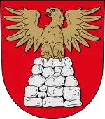 Coat of arms | |
 Location of Kumlinge in Finland | |
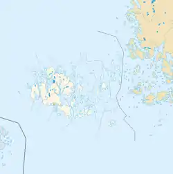 Kumlinge Location in Åland | |
| Coordinates: 60°15.5′N 020°46.7′E / 60.2583°N 20.7783°E | |
| Country | |
| Region | Åland |
| Sub-region | Archipelago sub-region |
| Government | |
| • Municipal manager | Christian Dreyer |
| • Chairman of municipality council | Mats Perämaa |
| • Chairwoman of municipality executive board | Gun-Mari Lindholm |
| Area (2018-01-01)[1] | |
| • Total | 865.88 km2 (334.32 sq mi) |
| • Land | 99.06 km2 (38.25 sq mi) |
| • Water | 761.12 km2 (293.87 sq mi) |
| • Rank | 299th largest in Finland |
| Population (2023-09-30)[2] | |
| • Total | 293 |
| • Rank | 307th largest in Finland |
| • Density | 2.96/km2 (7.7/sq mi) |
| Population by native language | |
| • Swedish | 84.6% (official) |
| • Finnish | 6.5% |
| • Others | 8.8% |
| Population by age | |
| • 0 to 14 | 10.1% |
| • 15 to 64 | 51.8% |
| • 65 or older | 38.1% |
| Time zone | UTC+02:00 (EET) |
| • Summer (DST) | UTC+03:00 (EEST) |
| Website | www.kumlinge.ax |
Kumlinge is a municipality consisting of a group of islands in Åland, an autonomous territory of Finland. Kumlinge, which is also the name of the largest island in the group, means "rocky passage."
The municipality has a population of 293 (30 September 2023)[2] and covers an area of 865.88 square kilometres (334.32 sq mi) of which 761.12 km2 (293.87 sq mi) is water.[1] The population density is 2.96 inhabitants per square kilometre (7.7/sq mi).
84.6% of the population is Swedish-speaking, 6.5% is Finnish-speaking, and 8.8% speak other languages.[3]
The Kumlinge Airfield is situated on the main island.
History
The first visitors to Kumlinge were Vikings who stopped there during their voyages. The first permanent residents arrived in the 13th century. According to taxrolls from the 16th century there were about a dozen houses on the main island at the time, home to mostly farmers and fishermen. In the 20th century the population of Kumlinge slowly began to decline.
Climate
Kumlinge has a humid continental climate (Dfb) with significant moderation from the Archipelago sea.
| Climate data for Kumlinge Kirkonkylä (1991–2020 normals, extremes 2000- present) | |||||||||||||
|---|---|---|---|---|---|---|---|---|---|---|---|---|---|
| Month | Jan | Feb | Mar | Apr | May | Jun | Jul | Aug | Sep | Oct | Nov | Dec | Year |
| Record high °C (°F) | 9.0 (48.2) |
7.7 (45.9) |
13.5 (56.3) |
19.5 (67.1) |
25.5 (77.9) |
27.7 (81.9) |
31.2 (88.2) |
28.1 (82.6) |
23.1 (73.6) |
17.1 (62.8) |
14.1 (57.4) |
9.9 (49.8) |
31.2 (88.2) |
| Mean daily maximum °C (°F) | 0.7 (33.3) |
−0.4 (31.3) |
2.2 (36.0) |
7.0 (44.6) |
12.4 (54.3) |
17.0 (62.6) |
20.4 (68.7) |
19.9 (67.8) |
15.2 (59.4) |
9.4 (48.9) |
5.3 (41.5) |
2.6 (36.7) |
9.3 (48.7) |
| Daily mean °C (°F) | −1.2 (29.8) |
−2.5 (27.5) |
−0.4 (31.3) |
3.6 (38.5) |
8.7 (47.7) |
13.4 (56.1) |
17.2 (63.0) |
17.0 (62.6) |
12.8 (55.0) |
7.7 (45.9) |
3.7 (38.7) |
1.0 (33.8) |
6.8 (44.2) |
| Mean daily minimum °C (°F) | −3.1 (26.4) |
−4.7 (23.5) |
−2.7 (27.1) |
1.0 (33.8) |
5.7 (42.3) |
10.6 (51.1) |
14.5 (58.1) |
14.6 (58.3) |
10.8 (51.4) |
5.9 (42.6) |
2.1 (35.8) |
−0.7 (30.7) |
4.5 (40.1) |
| Record low °C (°F) | −26.1 (−15.0) |
−23.0 (−9.4) |
−17.5 (0.5) |
−6.3 (20.7) |
−0.5 (31.1) |
3.2 (37.8) |
9.5 (49.1) |
7.5 (45.5) |
3.9 (39.0) |
−3.9 (25.0) |
−11.0 (12.2) |
−20.0 (−4.0) |
−26.1 (−15.0) |
| Source 1: FMI climatological normals for Finland 1991-2020[5] | |||||||||||||
| Source 2: Record highs and lows 2000- present[6] | |||||||||||||
Demographics
| Island | Population |
|---|---|
| Kumlinge | 318 |
| Enklinge | 87 |
| Seglinge | 51 |
| Björkö | 20 |
| ther (e.g. in hospitals) | 3 |
Sights

The church in the village is dedicated to St. Anne and dates from the 15th century. There are two farm museums in Kumlinge: Hermas museigård and Sjölunds gårdsmuseum. There is also a memorial stone in Fälberget which is dedicated to the war of 1808 when a Russian battalion was defeated in the village of Kumlinge. The old post route also goes through Kumlinge. There is also an old but still operational pharmacy on Kumlinge with its old inventory.
References
- 1 2 "Area of Finnish Municipalities 1.1.2018" (PDF). National Land Survey of Finland. Retrieved 30 January 2018.
- 1 2 "Preliminary population statistics 2023, September". StatFin. Statistics Finland. Retrieved 26 October 2023.
- 1 2 "Demographic Structure by area as of 31 December 2022". Statistics Finland's PX-Web databases. Statistics Finland. Retrieved 6 September 2023.
- ↑ "Population according to age (1-year) and sex by area and the regional division of each statistical reference year, 2003–2020". StatFin. Statistics Finland. Retrieved 2 May 2021.
- ↑ "FMI normals 1991-2020". fmi.fi. Retrieved 24 April 2023.
- ↑ "FMI open data". FMI. Retrieved 24 April 2023.
External links
 Media related to Kumlinge at Wikimedia Commons
- Municipality of Kumlinge – Official website
- Map of Kumlinge

Places adjacent to Kumlinge | ||||||||||||||||
|---|---|---|---|---|---|---|---|---|---|---|---|---|---|---|---|---|
| ||||||||||||||||