La Bâtie-Vieille | |
|---|---|
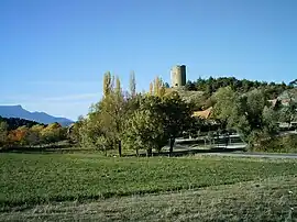 The 12th century tower overlooks the village | |
Location of La Bâtie-Vieille | |
 La Bâtie-Vieille 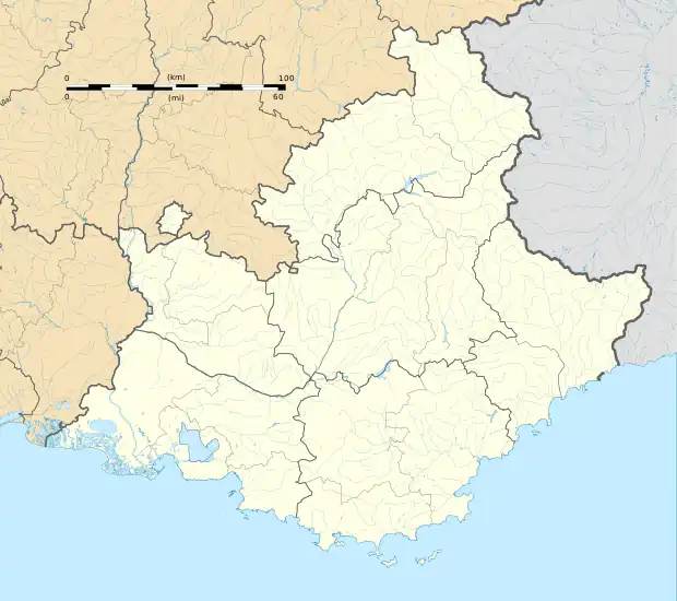 La Bâtie-Vieille | |
| Coordinates: 44°33′17″N 6°09′46″E / 44.5547°N 6.1628°E | |
| Country | France |
| Region | Provence-Alpes-Côte d'Azur |
| Department | Hautes-Alpes |
| Arrondissement | Gap |
| Canton | Tallard |
| Intercommunality | Serre-Ponçon Val d'Avance |
| Government | |
| • Mayor (2020–2026) | Francis Cester[1] |
| Area 1 | 9.05 km2 (3.49 sq mi) |
| Population | 327 |
| • Density | 36/km2 (94/sq mi) |
| Time zone | UTC+01:00 (CET) |
| • Summer (DST) | UTC+02:00 (CEST) |
| INSEE/Postal code | 05018 /05000 |
| Elevation | 798–1,152 m (2,618–3,780 ft) (avg. 1,030 m or 3,380 ft) |
| 1 French Land Register data, which excludes lakes, ponds, glaciers > 1 km2 (0.386 sq mi or 247 acres) and river estuaries. | |
La Bâtie-Vieille (French pronunciation: [la bati vjɛj]; Occitan: La Bastia Vielha) is a commune in the Hautes-Alpes department in southeastern France.
Location
The village is 5 km (3.1 mi) away from La Bâtie-Neuve, 8 km from Gap, 11 km (6.8 mi) from Chorges and 21 km (13 mi) from Tallard.
Population
| Year | Pop. | ±% p.a. |
|---|---|---|
| 1968 | 106 | — |
| 1975 | 89 | −2.47% |
| 1982 | 166 | +9.31% |
| 1990 | 208 | +2.86% |
| 1999 | 246 | +1.88% |
| 2007 | 257 | +0.55% |
| 2012 | 301 | +3.21% |
| 2017 | 342 | +2.59% |
| Source: INSEE[3] | ||
See also
References
- ↑ "Répertoire national des élus: les maires". data.gouv.fr, Plateforme ouverte des données publiques françaises (in French). 2 December 2020.
- ↑ "Populations légales 2021". The National Institute of Statistics and Economic Studies. 28 December 2023.
- ↑ Population en historique depuis 1968, INSEE
Wikimedia Commons has media related to La Bâtie-Vieille.
This article is issued from Wikipedia. The text is licensed under Creative Commons - Attribution - Sharealike. Additional terms may apply for the media files.