La Chapelle-de-Guinchay | |
|---|---|
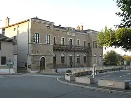 The town hall in La Chapelle-de-Guinchay | |
Location of La Chapelle-de-Guinchay | |
 La Chapelle-de-Guinchay 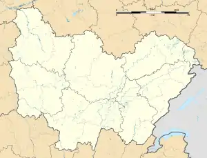 La Chapelle-de-Guinchay | |
| Coordinates: 46°12′41″N 4°45′19″E / 46.2114°N 4.7553°E | |
| Country | France |
| Region | Bourgogne-Franche-Comté |
| Department | Saône-et-Loire |
| Arrondissement | Mâcon |
| Canton | La Chapelle-de-Guinchay |
| Intercommunality | Mâconnais Beaujolais Agglomération |
| Government | |
| • Mayor (2020–2026) | Herve Carreau[1] |
| Area 1 | 12.44 km2 (4.80 sq mi) |
| Population | 4,082 |
| • Density | 330/km2 (850/sq mi) |
| Time zone | UTC+01:00 (CET) |
| • Summer (DST) | UTC+02:00 (CEST) |
| INSEE/Postal code | 71090 /71570 |
| Elevation | 168–295 m (551–968 ft) (avg. 191 m or 627 ft) |
| 1 French Land Register data, which excludes lakes, ponds, glaciers > 1 km2 (0.386 sq mi or 247 acres) and river estuaries. | |
La Chapelle-de-Guinchay (French pronunciation: [la ʃapɛl də ɡɛ̃ʃɛ]) is a commune in the Saône-et-Loire department in the region of Bourgogne-Franche-Comté in eastern France.
Population
| Year | Pop. | ±% p.a. |
|---|---|---|
| 1968 | 2,009 | — |
| 1975 | 2,135 | +0.87% |
| 1982 | 2,213 | +0.51% |
| 1990 | 2,233 | +0.11% |
| 1999 | 2,595 | +1.68% |
| 2007 | 3,446 | +3.61% |
| 2012 | 3,879 | +2.40% |
| 2017 | 4,121 | +1.22% |
| Source: INSEE[3] | ||
See also
References
- ↑ "Répertoire national des élus: les maires" (in French). data.gouv.fr, Plateforme ouverte des données publiques françaises. 13 September 2022.
- ↑ "Populations légales 2021". The National Institute of Statistics and Economic Studies. 28 December 2023.
- ↑ Population en historique depuis 1968, INSEE
Wikimedia Commons has media related to La Chapelle-de-Guinchay.
This article is issued from Wikipedia. The text is licensed under Creative Commons - Attribution - Sharealike. Additional terms may apply for the media files.