La Unión, Sucre | |
|---|---|
Municipality and town | |
.svg.png.webp) Flag | |
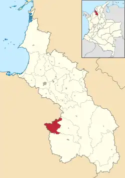 Location of the municipality and town of La Unión, Sucre in the Sucre Department of Colombia. | |
| Country | |
| Department | Sucre Department |
| Area | |
| • Total | 224 km2 (86 sq mi) |
| Population (Census 2018[2]) | |
| • Total | 11,510 |
| • Density | 51/km2 (130/sq mi) |
| Time zone | UTC-5 (Colombia Standard Time) |
La Unión is a town and municipality located in the Sucre Department, northern Colombia.
References
- (in Spanish) Gobernacion de Sucre - La Unión
- (in Spanish) La Unión official website
- ↑ "Municipalities of Colombia". statoids. Retrieved 30 April 2020.
- ↑ "Censo Nacional de Población y Vivienda 2018" (in Spanish). DANE. Retrieved 30 April 2020.
Municipalities in Sucre Department | ||
|---|---|---|
8°51′38″N 75°16′50″W / 8.86056°N 75.2806°W
This article is issued from Wikipedia. The text is licensed under Creative Commons - Attribution - Sharealike. Additional terms may apply for the media files.