Lama | |
|---|---|
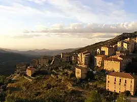 Lama and the Ostriconi valley | |
Location of Lama | |
 Lama 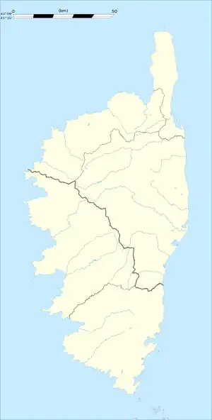 Lama | |
| Coordinates: 42°34′39″N 9°10′22″E / 42.5775°N 9.1728°E | |
| Country | France |
| Region | Corsica |
| Department | Haute-Corse |
| Arrondissement | Calvi |
| Canton | L'Île-Rousse |
| Government | |
| • Mayor (2020–2026) | Attilius Ceccaldi[1] |
| Area 1 | 19.92 km2 (7.69 sq mi) |
| Population | 150 |
| • Density | 7.5/km2 (20/sq mi) |
| Time zone | UTC+01:00 (CET) |
| • Summer (DST) | UTC+02:00 (CEST) |
| INSEE/Postal code | 2B136 /20218 |
| Elevation | 120–1,535 m (394–5,036 ft) (avg. 480 m or 1,570 ft) |
| 1 French Land Register data, which excludes lakes, ponds, glaciers > 1 km2 (0.386 sq mi or 247 acres) and river estuaries. | |
Lama (French pronunciation: [lama]) is a commune in the Haute-Corse department of France on the island of Corsica.
Population
| Year | Pop. | ±% |
|---|---|---|
| 1962 | 225 | — |
| 1968 | 237 | +5.3% |
| 1975 | 174 | −26.6% |
| 1982 | 120 | −31.0% |
| 1990 | 98 | −18.3% |
| 1999 | 130 | +32.7% |
| 2008 | 176 | +35.4% |
See also
References
- ↑ "Répertoire national des élus: les maires". data.gouv.fr, Plateforme ouverte des données publiques françaises (in French). 2 December 2020.
- ↑ "Populations légales 2021". The National Institute of Statistics and Economic Studies. 28 December 2023.
Wikimedia Commons has media related to Lama (Haute-Corse).
This article is issued from Wikipedia. The text is licensed under Creative Commons - Attribution - Sharealike. Additional terms may apply for the media files.