Le Bonhomme | |
|---|---|
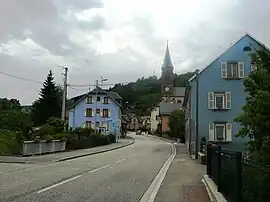 The main road in Le Bonhomme | |
.svg.png.webp) Coat of arms | |
Location of Le Bonhomme | |
 Le Bonhomme 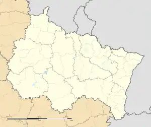 Le Bonhomme | |
| Coordinates: 48°10′24″N 7°06′51″E / 48.1733°N 7.1142°E | |
| Country | France |
| Region | Grand Est |
| Department | Haut-Rhin |
| Arrondissement | Colmar-Ribeauvillé |
| Canton | Sainte-Marie-aux-Mines |
| Intercommunality | Vallée de Kaysersberg |
| Government | |
| • Mayor (2020–2026) | Frédéric Perrin[1] |
| Area 1 | 21.98 km2 (8.49 sq mi) |
| Population | 749 |
| • Density | 34/km2 (88/sq mi) |
| Time zone | UTC+01:00 (CET) |
| • Summer (DST) | UTC+02:00 (CEST) |
| INSEE/Postal code | 68044 /68650 |
| Elevation | 644–1,231 m (2,113–4,039 ft) (avg. 690 m or 2,260 ft) |
| 1 French Land Register data, which excludes lakes, ponds, glaciers > 1 km2 (0.386 sq mi or 247 acres) and river estuaries. | |
Le Bonhomme (French pronunciation: [lə bɔnɔm] ⓘ; German: Diedolshausen; Alsatian: Bonom) is a village and commune in the Haut-Rhin département of north-eastern France. It lies at the eastern foot of the Col du Bonhomme.
See also
References
- ↑ "Répertoire national des élus: les maires" (in French). data.gouv.fr, Plateforme ouverte des données publiques françaises. 13 September 2022.
- ↑ "Populations légales 2021". The National Institute of Statistics and Economic Studies. 28 December 2023.
Wikimedia Commons has media related to Le Bonhomme.
This article is issued from Wikipedia. The text is licensed under Creative Commons - Attribution - Sharealike. Additional terms may apply for the media files.