Longfossé | |
|---|---|
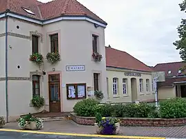 The town hall and school of Longfossé | |
 Coat of arms | |
Location of Longfossé | |
 Longfossé 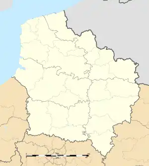 Longfossé | |
| Coordinates: 50°39′10″N 1°48′23″E / 50.6528°N 1.8064°E | |
| Country | France |
| Region | Hauts-de-France |
| Department | Pas-de-Calais |
| Arrondissement | Boulogne-sur-Mer |
| Canton | Desvres |
| Intercommunality | CC Desvres-Samer |
| Government | |
| • Mayor (2020–2026) | Anita Thomas[1] |
| Area 1 | 10.22 km2 (3.95 sq mi) |
| Population | 1,506 |
| • Density | 150/km2 (380/sq mi) |
| Time zone | UTC+01:00 (CET) |
| • Summer (DST) | UTC+02:00 (CEST) |
| INSEE/Postal code | 62524 /62240 |
| Elevation | 39–207 m (128–679 ft) (avg. 91 m or 299 ft) |
| 1 French Land Register data, which excludes lakes, ponds, glaciers > 1 km2 (0.386 sq mi or 247 acres) and river estuaries. | |
Longfossé (French pronunciation: [lɔ̃fose]) is a commune in the Pas-de-Calais department in the Hauts-de-France region of France.[3]
Geography
Longfossé is situated some 9 miles (14 km) southeast of Boulogne, at the junction of the D204 and D215 roads..
Population
| Year | Pop. | ±% p.a. |
|---|---|---|
| 1968 | 1,151 | — |
| 1975 | 1,148 | −0.04% |
| 1982 | 1,160 | +0.15% |
| 1990 | 1,218 | +0.61% |
| 1999 | 1,226 | +0.07% |
| 2007 | 1,272 | +0.46% |
| 2012 | 1,420 | +2.23% |
| 2017 | 1,452 | +0.45% |
| Source: INSEE[4] | ||
Places of interest
- The church of St.Pierre, dating from the seventeenth century.
- An eighteenth-century manorhouse.
Gallery
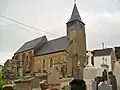 St.Pierre Church
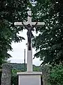 A crucifix in the town
See also
References
- ↑ "Répertoire national des élus: les maires". data.gouv.fr, Plateforme ouverte des données publiques françaises (in French). 9 August 2021.
- ↑ "Populations légales 2021". The National Institute of Statistics and Economic Studies. 28 December 2023.
- ↑ INSEE commune file
- ↑ Population en historique depuis 1968, INSEE
Wikimedia Commons has media related to Longfossé.
This article is issued from Wikipedia. The text is licensed under Creative Commons - Attribution - Sharealike. Additional terms may apply for the media files.