Měchenice | |
|---|---|
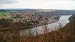 View of Měchenice from Oleško | |
 Flag  Coat of arms | |
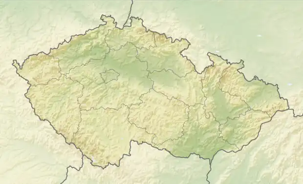 Měchenice Location in the Czech Republic | |
| Coordinates: 49°54′30″N 14°23′22″E / 49.90833°N 14.38944°E | |
| Country | |
| Region | Central Bohemian |
| District | Prague-West |
| First mentioned | 999 |
| Area | |
| • Total | 1.33 km2 (0.51 sq mi) |
| Elevation | 205 m (673 ft) |
| Population (2023-01-01)[1] | |
| • Total | 851 |
| • Density | 640/km2 (1,700/sq mi) |
| Time zone | UTC+1 (CET) |
| • Summer (DST) | UTC+2 (CEST) |
| Postal code | 252 06 |
| Website | ou |
Měchenice is a municipality and village in Prague-West District in the Central Bohemian Region of the Czech Republic. It has about 900 inhabitants.
Geography
Měchenice is located about 12 kilometres (7 mi) south of Prague. It lies in the Benešov Uplands on the left bank of the river Vltava.
History

Main street
Měchenice is one of the oldest settlements in Bohemia. The first written mention of Měchenice is from 999 when Duke Boleslaus II donated Měchenice to the Ostrov Monastery.[2]
Transport
Měchenice lies on a railway line of local importance heading from Prague to Čisovice.
Sport
The football club AFK Měchenice was founded in 1927. Today known as TJ Sokol Měchenice, it plays on lower amateur tiers. The tennis club was founded in 1985.[2]
Sights
There are no cultural monuments.[3]
References
- ↑ "Population of Municipalities – 1 January 2023". Czech Statistical Office. 2023-05-23.
- 1 2 "Historie" (in Czech). Obec Měchenice. Retrieved 2021-06-23.
- ↑ "Výsledky vyhledávání: Kulturní památky, okres Praha-západ". Ústřední seznam kulturních památek (in Czech). National Heritage Institute. Retrieved 2023-05-31.
External links
Wikimedia Commons has media related to Měchenice.
This article is issued from Wikipedia. The text is licensed under Creative Commons - Attribution - Sharealike. Additional terms may apply for the media files.