Mañazo
Mañasu | |
|---|---|
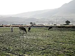 Cows on a meadow in Mañazo District | |
| Country | |
| Region | Puno |
| Province | Puno |
| Founded | January 30, 1953 |
| Capital | Mañazo |
| Government | |
| • Mayor | Miguel Gabriel Quispe Achata |
| Area | |
| • Total | 410.67 km2 (158.56 sq mi) |
| Elevation | 3,926 m (12,881 ft) |
| Population | |
| • Total | 5,537 |
| • Density | 13/km2 (35/sq mi) |
| Time zone | UTC-5 (PET) |
| UBIGEO | 210109 |
Mañazo (Aymara Mañasu, meaning butcher) is one of fifteen districts of the province Puno in Peru.[1]
Ethnic groups
The people in the district are mainly indigenous citizens of Quechua descent. Quechua is the language which the majority of the population (63.59%) learnt to speak in childhood, 35.92% of the residents started speaking using the Spanish language (2007 Peru Census).[2]
Climate
| Climate data for Mañazo (elevation 3,931 m (12,897 ft), 1991–2020 normals) | |||||||||||||
|---|---|---|---|---|---|---|---|---|---|---|---|---|---|
| Month | Jan | Feb | Mar | Apr | May | Jun | Jul | Aug | Sep | Oct | Nov | Dec | Year |
| Mean daily maximum °C (°F) | 16.0 (60.8) |
15.6 (60.1) |
15.8 (60.4) |
16.2 (61.2) |
16.4 (61.5) |
15.9 (60.6) |
15.8 (60.4) |
16.7 (62.1) |
17.6 (63.7) |
18.2 (64.8) |
18.7 (65.7) |
17.6 (63.7) |
16.7 (62.1) |
| Mean daily minimum °C (°F) | 4.3 (39.7) |
4.4 (39.9) |
3.6 (38.5) |
1.8 (35.2) |
−0.6 (30.9) |
−2.4 (27.7) |
−2.8 (27.0) |
−1.8 (28.8) |
0.1 (32.2) |
1.9 (35.4) |
2.9 (37.2) |
3.9 (39.0) |
1.3 (34.3) |
| Average precipitation mm (inches) | 135.6 (5.34) |
134.0 (5.28) |
91.2 (3.59) |
45.6 (1.80) |
5.0 (0.20) |
2.0 (0.08) |
3.0 (0.12) |
5.3 (0.21) |
15.1 (0.59) |
32.1 (1.26) |
48.8 (1.92) |
97.9 (3.85) |
615.6 (24.24) |
| Source: National Meteorology and Hydrology Service of Peru[3] | |||||||||||||
See also
References
- ↑ (in Spanish) Instituto Nacional de Estadística e Informática. Banco de Información Distrital Archived April 23, 2008, at the Wayback Machine. Retrieved April 11, 2008.
- ↑ inei.gob.pe Archived January 27, 2013, at the Wayback Machine INEI, Peru, Censos Nacionales 2007, Frequencias: Preguntas de Población: Idioma o lengua con el que aprendió hablar (in Spanish)
- ↑ "Normales Climáticas Estándares y Medias 1991-2020". National Meteorology and Hydrology Service of Peru. Archived from the original on 21 August 2023. Retrieved 25 October 2023.
| |
|---|---|
| Azángaro | |
| Carabaya | |
| Chucuito | |
| El Collao | |
| Huancané | |
| Lampa | |
| Melgar | |
| Moho | |
| Puno | |
| San Antonio de Putina | |
| San Román | |
| Sandia | |
| Yunguyo | |
This article is issued from Wikipedia. The text is licensed under Creative Commons - Attribution - Sharealike. Additional terms may apply for the media files.