Borough of Meshoppen | |
|---|---|
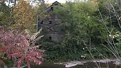 Meshoppen's Old White Mill | |
 Location of Meshoppen in Wyoming County, Pennsylvania. | |
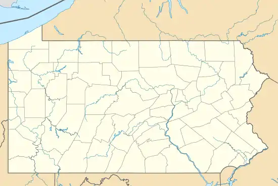 Meshoppen Location of Meshoppen in Pennsylvania  Meshoppen Meshoppen (the United States) | |
| Coordinates: 41°36′53″N 76°02′47″W / 41.61472°N 76.04639°W | |
| Country | United States |
| State | Pennsylvania |
| County | Wyoming |
| Founded by | A Sterling |
| Government | |
| • Mayor | Chris R. Baker |
| Area | |
| • Total | 0.77 sq mi (2.00 km2) |
| • Land | 0.69 sq mi (1.79 km2) |
| • Water | 0.08 sq mi (0.21 km2) |
| Elevation | 623 ft (190 m) |
| Population | |
| • Total | 326 |
| • Density | 471.78/sq mi (182.27/km2) |
| Time zone | UTC-5 (EST) |
| • Summer (DST) | UTC-4 (EDT) |
| ZIP Code | 18630 |
| Area code | 570 |
| FIPS code | 42-48856 |
| Website | www |
Meshoppen is a borough that is located in Wyoming County, Pennsylvania, United States. The population was 326 at the time of the 2020 census.[3]
History
The borough takes its name from Meshoppen Creek, a Native American name purported to mean "glass beads."[4]
The Old White Mill was listed on the National Register of Historic Places in 1975.[5]
Geography
According to the United States Census Bureau, the borough has a total area of 0.7 square miles (1.8 km2), all land.
Demographics
| Census | Pop. | Note | %± |
|---|---|---|---|
| 1880 | 554 | — | |
| 1890 | 597 | 7.8% | |
| 1900 | 609 | 2.0% | |
| 1910 | 630 | 3.4% | |
| 1920 | 608 | −3.5% | |
| 1930 | 525 | −13.7% | |
| 1940 | 580 | 10.5% | |
| 1950 | 574 | −1.0% | |
| 1960 | 470 | −18.1% | |
| 1970 | 482 | 2.6% | |
| 1980 | 571 | 18.5% | |
| 1990 | 439 | −23.1% | |
| 2000 | 459 | 4.6% | |
| 2010 | 563 | 22.7% | |
| 2020 | 326 | −42.1% | |
| 2021 (est.) | 327 | [3] | 0.3% |
| Sources:[6][7][8][2] | |||
As of the census[9] of 2010, there were 563 people, 190 households, and 128 families residing in the borough.
The population density was 804.3 inhabitants per square mile (310.5/km2). There were 217 housing units at an average density of 310 per square mile (120/km2).
The racial makeup of the borough was 89.2% White, 3.7% African American, 0.65% Native American, 0.65% Asian, 4.3% from other races, and 1.4% from two or more races. Hispanic or Latino of any race were 10.1% of the population.
There were 190 households, out of which 46.3% had children under the age of eighteen living with them; 38.9% were married couples living together, 18.9% had a female householder with no husband present, and 32.6% were non-families. 23.7% of all households were made up of individuals, and 5.8% had someone living alone who was sixty-five years of age or older. The average household size was 2.96 and the average family size was 3.46.
Within the borough, the population was spread out, with 31.4% of residents who were under the age of eighteen, 61.7% who were aged eighteen to sixty-four, and 6.9% who were sixty-five years of age or older. The median age was twenty-nine years.
The median income for a household in the borough was $40,714, and the median income for a family was $38,594. Males had a median income of $30,417 compared with that of $22,063 for females.
The per capita income for the borough was $16,588.
Approximately 13.5% of families and 22.7% of the population were living below the poverty line, including 37.2% of those who were under the age of eighteen and 15% of those who were aged sixty-five or older.
Government
Mayor
| Bruce Marshall | Republican |
Council
| Council Member | Party |
|---|---|
| Herb Bevan | Republican |
| John V. Bunnell | Democratic |
| Michael Vorhees | Republican |
| Mike Loyd | Democratic |
| Bruce Priestner | Republican |
| Doris Pickett | Republican |
| Jack Vaow | Republican |
Gallery
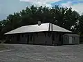 Former Lehigh Valley Railroad, Meshoppen
References
- ↑ "ArcGIS REST Services Directory". United States Census Bureau. Retrieved October 12, 2022.
- 1 2 "Census Population API". United States Census Bureau. Retrieved Oct 12, 2022.
- 1 2 Bureau, US Census. "City and Town Population Totals: 2020—2021". Census.gov. US Census Bureau. Retrieved August 5, 2022.
- ↑ Espenshade, Abraham Howry (1925). Pennsylvania Place Names. Evangelical Press. p. 285. ISBN 978-0-8063-0416-8.
- ↑ "National Register Information System". National Register of Historic Places. National Park Service. March 13, 2009.
- ↑ "Census of Population and Housing". U.S. Census Bureau. Retrieved 11 December 2013.
- ↑ "U.S. Census website". United States Census Bureau. Retrieved 2008-01-31.
- ↑ "Incorporated Places and Minor Civil Divisions Datasets: Subcounty Resident Population Estimates: April 1, 2010 to July 1, 2012". Population Estimates. U.S. Census Bureau. Archived from the original on 11 June 2013. Retrieved 11 December 2013.
- ↑ "U.S. Census website". United States Census Bureau. Retrieved 2011-05-14.
External links
Municipalities and communities of Wyoming County, Pennsylvania, United States | ||
|---|---|---|
| Boroughs | 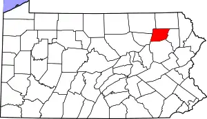 | |
| Townships | ||
| CDPs | ||
| Unincorporated communities | ||
| Ghost town | ||