Mikulov | |
|---|---|
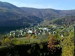 Mikulov seen from the Bouřňák hill | |
.png.webp) Coat of arms | |
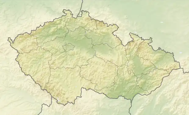 Mikulov Location in the Czech Republic | |
| Coordinates: 50°41′16″N 13°43′18″E / 50.68778°N 13.72167°E | |
| Country | |
| Region | Ústí nad Labem |
| District | Teplice |
| First mentioned | 1404 |
| Area | |
| • Total | 3.19 km2 (1.23 sq mi) |
| Elevation | 595 m (1,952 ft) |
| Population (2023-01-01)[1] | |
| • Total | 222 |
| • Density | 70/km2 (180/sq mi) |
| Time zone | UTC+1 (CET) |
| • Summer (DST) | UTC+2 (CEST) |
| Postal code | 419 01 |
| Website | www |
Mikulov (German: Niklasberg) is a municipality and village in Teplice District in the Ústí nad Labem Region of the Czech Republic. It has about 200 inhabitants.
Geography
Mikulov is located about 9 kilometres (6 mi) northwest of Teplice and 21 km (13 mi) west of Ústí nad Labem. The municipality briefly borders Germany in the north. It lies in the Ore Mountains. The highest point is at 827 m (2,713 ft) above sea level. The Divoká Bystřice River flows through the northern part of the municipality.
References
External links
Wikimedia Commons has media related to Mikulov (Teplice District).
This article is issued from Wikipedia. The text is licensed under Creative Commons - Attribution - Sharealike. Additional terms may apply for the media files.