| Montecristo Trifinio National Park | |
|---|---|
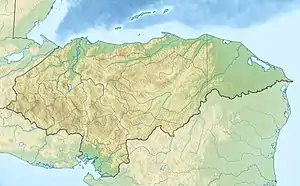 Location of Montecristo Trifinio in Honduras | |
| Location | Honduras |
| Coordinates | 14°26′31″N 89°19′32″W / 14.44194°N 89.32556°W[1] |
| Area | 54 km2 (21 sq mi)[1] |
| Established | 1 January 1987[1] |
Montecristo Trifinio National Park is a national park in Honduras. It was established on 1 January 1987 and covers an area of 54 square kilometres.[1]
The Montecristo massif is an area where the borders of Honduras, Guatemala and El Salvador meet, and its protection was a joint initiative of these three countries, which resulted in the creation of the national parks in Honduras and El Salvador, as well as the Guatemalan Trifinio Biosphere Reserve.
References
- 1 2 3 4 "Honduras - Montecristo Trifinio". United Nations Environment Programme. Retrieved 1 March 2010.
This article is issued from Wikipedia. The text is licensed under Creative Commons - Attribution - Sharealike. Additional terms may apply for the media files.