Oldřišov | |
|---|---|
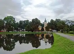 Centre of Oldřišov | |
 Flag  Coat of arms | |
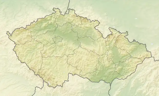 Oldřišov Location in the Czech Republic | |
| Coordinates: 49°59′29″N 17°57′39″E / 49.99139°N 17.96083°E | |
| Country | |
| Region | Moravian-Silesian |
| District | Opava |
| First mentioned | 1234 |
| Area | |
| • Total | 15.78 km2 (6.09 sq mi) |
| Elevation | 283 m (928 ft) |
| Population (2023-01-01)[1] | |
| • Total | 1,472 |
| • Density | 93/km2 (240/sq mi) |
| Time zone | UTC+1 (CET) |
| • Summer (DST) | UTC+2 (CEST) |
| Postal code | 747 33 |
| Website | www |
Oldřišov (German: Odersch) is a municipality and village in Opava District in the Moravian-Silesian Region of the Czech Republic. It has about 1,500 inhabitants. It is part of the historic Hlučín Region.
History
The first written mention of Oldřišov is from 1234.[2]
Demographics
| Year | Pop. | ±% |
|---|---|---|
| 1869 | 1,174 | — |
| 1880 | 1,282 | +9.2% |
| 1890 | 1,345 | +4.9% |
| 1900 | 1,441 | +7.1% |
| 1910 | 1,428 | −0.9% |
| 1921 | 1,378 | −3.5% |
| 1930 | 1,328 | −3.6% |
| 1950 | 1,199 | −9.7% |
| 1961 | 1,302 | +8.6% |
| 1970 | 1,247 | −4.2% |
| 1980 | 1,296 | +3.9% |
| 1991 | 1,238 | −4.5% |
| 2001 | 1,334 | +7.8% |
| 2011 | 1,311 | −1.7% |
| 2021 | 1,383 | +5.5% |
| Source: Censuses[3][4] | ||
References
- ↑ "Population of Municipalities – 1 January 2023". Czech Statistical Office. 2023-05-23.
- ↑ "Historie Oldřišova" (in Czech). Obec Oldřišov. Retrieved 2020-11-11.
- ↑ "Historický lexikon obcí České republiky 1869–2011 – Okres Opava" (in Czech). Czech Statistical Office. 2015-12-21.
- ↑ "Population Census 2021: Population by sex". Public Database. Czech Statistical Office. 2021-03-27.
External links
Wikimedia Commons has media related to Oldřišov.
This article is issued from Wikipedia. The text is licensed under Creative Commons - Attribution - Sharealike. Additional terms may apply for the media files.