Rokan Hilir Regency
(Kabupaten Rokan Hilir) | |
|---|---|
 Flag  Coat of arms | |
 | |
| Country | Indonesia |
| Province | Riau |
| Regency seat | Bagansiapiapi |
| Government | |
| • Regent | Afrizal Sintong |
| Area | |
| • Total | 8,851.59 km2 (3,417.62 sq mi) |
| Population (mid 2022 estimate)[1] | |
| • Total | 658,407 |
| • Density | 74/km2 (190/sq mi) |
| Time zone | UTC+7 (WIB) |
| Website | rohikab.go.id |
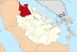
Rokan Hilir ("Lower Rokan") is a regency (kabupaten) of Riau Province, on Sumatra island, Indonesia. It was formed on 4 October 1999 from districts which had previously been the northwestern part of Bengkalis Regency.[2] It occupies the lower part of the catchment area of the Rokan River, and has an area of 8,851.59 km2. It had a population of 553,216 at the 2010 census[3] and 637,161 at the 2020 census;[4] the official estimate as at mid 2022 was 638,407 (comprising 337,559 males and 320,848 females).[1] The administrative centre of the Rokan Hilir Regency is located at the town of Bagansiapiapi.
Administrative districts
As at 2010, the regency was divided into thirteen districts (kecamatan), but two additional districts (Kubu Babusalam and Pekaitan) were created by splitting of the Kubu and Bangko districts respectively; and more recently three more districts (Tanjung Medan, Bagan Sinembah Raya and Balai Jaya) were added by splitting of the Pujud and Bagan Sinembah districts respectively. The eighteen districts are listed below with their areas and populations at the 2010 census[3] and the 2020 census,[4] together with the official estimates as at mid 2022.[1] The table also includes the locations of the district administrative centres, the number of administrative villages in each district (a total of 159 rural desa and 25 urban kelurahan), and its post code.
| Kode Wilayah | Name of District (kecamatan) | Area in km2 | Pop'n census 2010 | Pop'n census 2020 | Pop'n estimate mid 2022 | Admin Centre | No. of villages | Post code |
|---|---|---|---|---|---|---|---|---|
| 14.07.03 | Tanah Putih | 1,915.23 | 57,638 | 69,150 | 71,980 | Sedinginan | 17 (a) | 28985 |
| 14.07.08 | Pujud | 984.90 | 63,861 | 33,954 | 34,870 | Pujud | 11 (b) | 28983 |
| 14.07.09 | Tanah Putih Tanjung Melawan | 198.39 | 12,066 | 14,628 | 15,260 | Melayu Besar | 6 (b) | 28986 |
| 14.07.13 | Rantau Kopar | 231.13 | 5,636 | 6,592 | 6,830 | Rantau Kopar | 4 (c) | 28984 |
| 14.07.16 | Tanjung Medan | (a) | (d) | 36,282 | 37,010 | Tanjung Medan | 12 | 28983 |
| 14.07.05 | Bagan Sinembah | 847.35 | 131,862 | 69,825 | 71,580 | Bagan Batu | 13 (c) | 28992 |
| 14.07.11 | Simpang Kanan | 445.55 | 25,865 | 24,821 | 24,930 | Simpang Kanan | 6 (b) | 28994 |
| 14.07.17 | Bagan Sinembah Raya | (e) | (e) | 20,150 | 21,010 | Bagan Sinembah Raya | 10 (b) | 28992 |
| 14.07.18 | Balai Jaya | (e) | (e) | 53,404 | 53,870 | Balai Jaya | 11 (c) | 28992 |
| 14.07.01 | Kubu | 385.36 | 38,329 | 25,616 | 27,380 | Teluk Merbau | 10 (b) | 28991 |
| 14.07.06 | Pasir Limau Kapas | 669.63 | 33,405 | 37,258 | 38,240 | Panipahan | 8 (b) | 28995 |
| 14.07.15 | Kubu Babussalam | 675.70 | (f) | 23,836 | 24,860 | Rantau Panjang Kiri | 12 | 28990 |
| 14.07.02 | Bangko | 475.26 | 81,984 | 78,742 | 81,300 | Bagansiapiapi | 15 (h) | 28911 -28914 |
| 14.07.07 | Sinaboi | 335.48 | 11,081 | 18,373 | 19,930 | Sinaboi | 6 (b) | 28914 |
| 14.07.12 | Batu Hampar | 284.31 | 7,213 | 9,448 | 10,000 | Batayan | 5 (b) | 28912 |
| 14.07.14 | Pekaitan | 465.30 | (g) | 15,858 | 16,430 | Pedamaran | 10 | 28913 |
| 14.07.04 | Rimba Melintang | 235.48 | 32,162 | 37,624 | 38,970 | Rimba Melintang | 12 (b) | 28953 |
| 14.07.10 | Bangko Pusako | 732.52 | 52,114 | 61,600 | 63,940 | Bangko Kanan | 16 (c) | 28993 |
| Totals | 8,881.59 | 553,216 | 637,161 | 658,407 | Bagansiapiapi | 184 |
Notes: (a) including 3 kelurahan. (b) including 1 kelurahan. (c) including 2 kelurahan.
(d) the area and 2010 population of the new Tanjung Medan District is included in the figures for Pujud District, from which it was cut.
(e) the areas and 2010 populations of the new Bagan Sinembah Raya District and Balai Jaya District are included in the figures for Bagan Sinembah District, from which they were cut.
(f) the 2010 population of Kubu Babassalam District is included in the population figure for Kubu District, from which it was cut.
(g) the 2010 population of Pekaitan District is included in the population figure for Bangko District, from which it was cut. (h) including 5 kelurahan.
Towns with significant populations
- Bagansiapiapi
- Bagan Batu
- Panipahan
- Ujung Tanjung
- Pulau Halang