Sachkhere
საჩხერე | |
|---|---|
Town | |
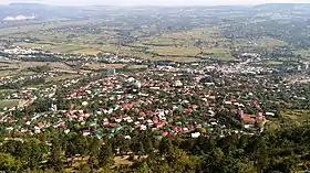 Sachkhere from Modinakhe fortress | |
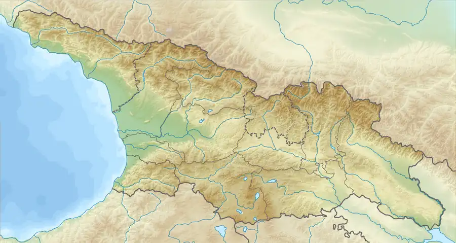 Sachkhere Location of Khoni in Georgia  Sachkhere Sachkhere (Imereti) | |
| Coordinates: 42°20′20″N 43°24′14″E / 42.33889°N 43.40389°E | |
| Country | |
| Region | Imereti |
| Municipality | Sachkhere |
| Elevation | 500 m (1,600 ft) |
| Population (2014)[1] | |
| • Total | 6,140 |
| Time zone | UTC+4 (Georgian Time) |
| Area code | +995 435 |
Sachkhere (Georgian: საჩხერე) is a town at the northern edge of the Imereti Province in Western Georgia. It is the center of the Sachkhere Municipality.
Farming is a major contributor to the economy of Sachkhere. Alva LLC estimates that there are 4,000 small and medium-sized farms and ranches in the region, supported by a program of technical assistance sponsored by USAID and administered by the Farmer-to-Farmer program of CNFA.[2]
Science
The microbiologist George Eliava (1892-1937) was born in Sachkhere.
Sport
Though small, Sachkhere is famous for having produced two Olympic weightlifting champions - Lasha Talakhadze and Giorgi Asanidze.
Climate
| Climate data for Sachkere (1991–2020) | |||||||||||||
|---|---|---|---|---|---|---|---|---|---|---|---|---|---|
| Month | Jan | Feb | Mar | Apr | May | Jun | Jul | Aug | Sep | Oct | Nov | Dec | Year |
| Record high °C (°F) | 20.0 (68.0) |
21.6 (70.9) |
26.0 (78.8) |
33.5 (92.3) |
39.5 (103.1) |
38.5 (101.3) |
41.9 (107.4) |
41.5 (106.7) |
39.0 (102.2) |
35.0 (95.0) |
29.5 (85.1) |
23.0 (73.4) |
41.9 (107.4) |
| Mean daily maximum °C (°F) | 7.3 (45.1) |
9.1 (48.4) |
13.1 (55.6) |
18.6 (65.5) |
23.2 (73.8) |
26.7 (80.1) |
29.5 (85.1) |
30.8 (87.4) |
26.5 (79.7) |
20.9 (69.6) |
14.4 (57.9) |
8.9 (48.0) |
19.1 (66.4) |
| Mean daily minimum °C (°F) | −2.0 (28.4) |
−1.6 (29.1) |
2.2 (36.0) |
6.4 (43.5) |
11.6 (52.9) |
15.5 (59.9) |
18.5 (65.3) |
18.4 (65.1) |
14.0 (57.2) |
8.3 (46.9) |
2.6 (36.7) |
−0.9 (30.4) |
7.8 (46.0) |
| Record low °C (°F) | −17.0 (1.4) |
−16.8 (1.8) |
−9.5 (14.9) |
−5.7 (21.7) |
0.2 (32.4) |
2.3 (36.1) |
8.3 (46.9) |
9.5 (49.1) |
1.8 (35.2) |
−3.2 (26.2) |
−9.5 (14.9) |
−20.0 (−4.0) |
−20.0 (−4.0) |
| Average precipitation mm (inches) | 74.7 (2.94) |
68.3 (2.69) |
84.0 (3.31) |
80.8 (3.18) |
91.7 (3.61) |
94.1 (3.70) |
74.2 (2.92) |
67.5 (2.66) |
82.0 (3.23) |
103.4 (4.07) |
86.2 (3.39) |
83.9 (3.30) |
990.8 (39.01) |
| Average precipitation days (≥ 1.0 mm) | 10.5 | 10.1 | 12.2 | 11.1 | 11.9 | 11.9 | 10.6 | 7.5 | 8.6 | 9.8 | 9.7 | 10.1 | 124.0 |
| Source: NOAA[3] | |||||||||||||
See also
References
- ↑ "Population Census 2014". www.geostat.ge. National Statistics Office of Georgia. November 2014. Retrieved 28 June 2021.
- ↑ Ioseb Gogitadze; Iza Komladze (2012). "Alva Farm Service Center". Alva. Retrieved 2012-01-27.
- ↑ "Sachkere Climate Normals 1991–2020". World Meteorological Organization Climatological Standard Normals (1991–2020). National Oceanic and Atmospheric Administration. Archived from the original on 2 September 2023. Retrieved 2 September 2023.
Wikimedia Commons has media related to Sachkhere.


This article is issued from Wikipedia. The text is licensed under Creative Commons - Attribution - Sharealike. Additional terms may apply for the media files.