Saint-Aubin-des-Châteaux | |
|---|---|
Commune | |
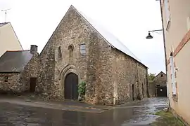 Chapel of the Templars | |
.svg.png.webp) Coat of arms | |
Location of Saint-Aubin-des-Châteaux | |
 Saint-Aubin-des-Châteaux 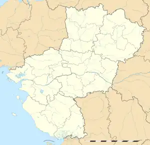 Saint-Aubin-des-Châteaux | |
| Coordinates: 47°43′15″N 1°29′06″W / 47.7208°N 1.485°W | |
| Country | France |
| Region | Pays de la Loire |
| Department | Loire-Atlantique |
| Arrondissement | Châteaubriant-Ancenis |
| Canton | Châteaubriant |
| Intercommunality | Châteaubriant-Derval |
| Government | |
| • Mayor (2020–2026) | Daniel Rabu[1] |
| Area 1 | 47.56 km2 (18.36 sq mi) |
| Population | 1,740 |
| • Density | 37/km2 (95/sq mi) |
| Time zone | UTC+01:00 (CET) |
| • Summer (DST) | UTC+02:00 (CEST) |
| INSEE/Postal code | 44153 /44110 |
| Elevation | 32–92 m (105–302 ft) (avg. 65 m or 213 ft) |
| 1 French Land Register data, which excludes lakes, ponds, glaciers > 1 km2 (0.386 sq mi or 247 acres) and river estuaries. | |
Saint-Aubin-des-Châteaux (French pronunciation: [sɛ̃.t‿obɛ̃ de ʃato] ⓘ; Breton: Sant-Albin-ar-C'hestell) is a commune in the Loire-Atlantique department in western France.[3]
Geography
The village is located in the northwestern part of the commune on the right bank of the river Chère, which flows southwest through the commune.
Population
| Year | Pop. | ±% p.a. |
|---|---|---|
| 1968 | 1,472 | — |
| 1975 | 1,387 | −0.85% |
| 1982 | 1,351 | −0.37% |
| 1990 | 1,346 | −0.05% |
| 1999 | 1,312 | −0.28% |
| 2007 | 1,502 | +1.70% |
| 2012 | 1,649 | +1.88% |
| 2017 | 1,795 | +1.71% |
| Source: INSEE[4] | ||
See also
References
- ↑ "Répertoire national des élus: les maires" (in French). data.gouv.fr, Plateforme ouverte des données publiques françaises. 13 September 2022.
- ↑ "Populations légales 2021". The National Institute of Statistics and Economic Studies. 28 December 2023.
- ↑ INSEE commune file
- ↑ Population en historique depuis 1968, INSEE
Wikimedia Commons has media related to Saint-Aubin-des-Châteaux.
This article is issued from Wikipedia. The text is licensed under Creative Commons - Attribution - Sharealike. Additional terms may apply for the media files.