Saint-Christophe-sur-Guiers | |
|---|---|
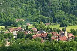 A general view of Saint-Christophe-sur-Guiers | |
 Coat of arms | |
Location of Saint-Christophe-sur-Guiers | |
 Saint-Christophe-sur-Guiers 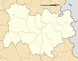 Saint-Christophe-sur-Guiers | |
| Coordinates: 45°26′17″N 5°46′29″E / 45.4381°N 5.7747°E | |
| Country | France |
| Region | Auvergne-Rhône-Alpes |
| Department | Isère |
| Arrondissement | Grenoble |
| Canton | Chartreuse-Guiers |
| Intercommunality | Cœur de Chartreuse |
| Government | |
| • Mayor (2022–2026) | Claude Coux[1] |
| Area 1 | 23.54 km2 (9.09 sq mi) |
| Population | 824 |
| • Density | 35/km2 (91/sq mi) |
| Time zone | UTC+01:00 (CET) |
| • Summer (DST) | UTC+02:00 (CEST) |
| INSEE/Postal code | 38376 /38380 |
| Elevation | 386–1,761 m (1,266–5,778 ft) |
| 1 French Land Register data, which excludes lakes, ponds, glaciers > 1 km2 (0.386 sq mi or 247 acres) and river estuaries. | |
Saint-Christophe-sur-Guiers (French pronunciation: [sɛ̃ kʁistɔf syʁ ɡje], literally Saint-Christophe on Guiers) is a commune in the Isère department in southeastern France.[3]
La Ruchère
La Ruchère, rural district, mainly famous for cross country skiing slopes, was attached to Saint-Christophe-sur-Guiers in 1794.
Population
| Year | Pop. | ±% p.a. |
|---|---|---|
| 1968 | 442 | — |
| 1975 | 430 | −0.39% |
| 1982 | 599 | +4.85% |
| 1990 | 709 | +2.13% |
| 1999 | 720 | +0.17% |
| 2009 | 764 | +0.59% |
| 2014 | 867 | +2.56% |
| 2020 | 813 | −1.07% |
| Source: INSEE[4] | ||
See also
References
- ↑ "Répertoire national des élus: les maires" (in French). data.gouv.fr, Plateforme ouverte des données publiques françaises. 13 September 2022.
- ↑ "Populations légales 2021". The National Institute of Statistics and Economic Studies. 28 December 2023.
- ↑ INSEE commune file
- ↑ Population en historique depuis 1968, INSEE
Wikimedia Commons has media related to Saint-Christophe-sur-Guiers.
This article is issued from Wikipedia. The text is licensed under Creative Commons - Attribution - Sharealike. Additional terms may apply for the media files.