Seekaskootch 119 | |
|---|---|
| Seekaskootch Indian Reserve No. 119 | |
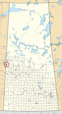 Location in Saskatchewan | |
| First Nation | Onion Lake |
| Country | Canada |
| Province | Saskatchewan |
| Area | |
| • Total | 15,492.2 ha (38,282.1 acres) |
| Population (2016)[2] | |
| • Total | 2,574 |
| • Density | 17/km2 (43/sq mi) |
| Community Well-Being Index[3] | 53 |
Seekaskootch 119 is an Indian reserve of the Onion Lake Cree Nation in Saskatchewan.[1][4] It is about 142 kilometres (88 mi) north-west of North Battleford. In the 2016 Canadian Census, it recorded a population of 2574 living in 578 of its 639 total private dwellings.[2] In the same year, its Community Well-Being index was calculated at 53 of 100, compared to 58.4 for the average First Nations community and 77.5 for the average non-Indigenous community.[3]
See also
References
- 1 2 "Reserve/Settlement/Village Detail". Crown–Indigenous Relations and Northern Affairs Canada. Government of Canada. Retrieved 12 August 2019.
- 1 2 "Census Profile, 2016 Census". Statistics Canada. 8 February 2017. Retrieved 10 August 2019.
- 1 2 "The Community Well-Being index". Indigenous Services Canada. 24 May 2019. Retrieved 9 October 2019.
- ↑ "Canada Lands Survey System - CLSS Map Browser". Natural Resources Canada. Retrieved 9 October 2019.
| Cities |
|  |
|---|---|---|
| Towns | ||
| Villages | ||
| Resort villages | ||
| Rural municipalities | ||
| First Nations | ||
| Indian reserves | ||
| Unincorporated communities | ||
53°42′03″N 109°53′25″W / 53.7007°N 109.8903°W
This article is issued from Wikipedia. The text is licensed under Creative Commons - Attribution - Sharealike. Additional terms may apply for the media files.