Tippecanoe Township | |
|---|---|
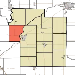 Location of Tippecanoe Township in Carroll County | |
| Coordinates: 40°36′45″N 86°43′36″W / 40.61250°N 86.72667°W | |
| Country | United States |
| State | Indiana |
| County | Carroll |
| Government | |
| • Type | Indiana township |
| Area | |
| • Total | 28.01 sq mi (72.5 km2) |
| • Land | 27.21 sq mi (70.5 km2) |
| • Water | 0.8 sq mi (2 km2) |
| Elevation | 650 ft (198 m) |
| Population (2010) | |
| • Total | 2,341 |
| • Density | 86/sq mi (33/km2) |
| FIPS code | 18-75824[2] |
| GNIS feature ID | 453894 |
Tippecanoe Township is one of fourteen townships in Carroll County, Indiana. As of the 2010 census, its population was 2,341 and it contained 1,186 housing units.[3]
History
Tippecanoe Township was organized in 1830.[4]
Carrollton Bridge was listed on the National Register of Historic Places in 2003.[5]
Geography
According to the 2010 census, the township has a total area of 28.01 square miles (72.5 km2), of which 27.21 square miles (70.5 km2) (or 97.14%) is land and 0.8 square miles (2.1 km2) (or 2.86%) is water.[3]
Unincorporated towns
Adjacent townships
- Jefferson (north)
- Adams (northeast)
- Deer Creek (east)
- Washington Township, Tippecanoe County (south)
- Prairie Township, White County (west)
Major highways
Cemeteries
The township contains two cemeteries: Benham and Pleasant Run.
References
- ↑ "US Board on Geographic Names". United States Geological Survey. October 25, 2007. Retrieved January 31, 2008.
- ↑ "U.S. Census website". United States Census Bureau. Retrieved January 31, 2008.
- 1 2 "Population, Housing Units, Area, and Density: 2010 - County -- County Subdivision and Place -- 2010 Census Summary File 1". United States Census. Archived from the original on February 12, 2020. Retrieved May 10, 2013.
- ↑ Odell, John Curtis (1916). History of Carroll County, Indiana: Its People, Industries and Institutions. B.F. Bowen. p. 86.
- ↑ "National Register Information System". National Register of Historic Places. National Park Service. July 9, 2010.
External links
Wikimedia Commons has media related to Tippecanoe Township, Carroll County, Indiana.
Municipalities and communities of Carroll County, Indiana, United States | ||
|---|---|---|
| City | Map of Indiana highlighting Carroll County | |
| Towns | ||
| Townships | ||
| CDPs | ||
| Other communities | ||
This article is issued from Wikipedia. The text is licensed under Creative Commons - Attribution - Sharealike. Additional terms may apply for the media files.