Tučapy | |
|---|---|
.jpg.webp) Centre of Tučapy | |
 Flag  Coat of arms | |
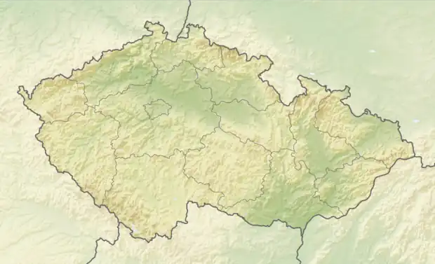 Tučapy Location in the Czech Republic | |
| Coordinates: 49°14′0″N 16°55′6″E / 49.23333°N 16.91833°E | |
| Country | |
| Region | South Moravian |
| District | Vyškov |
| First mentioned | 1358 |
| Area | |
| • Total | 5.29 km2 (2.04 sq mi) |
| Elevation | 260 m (850 ft) |
| Population (2023-01-01)[1] | |
| • Total | 596 |
| • Density | 110/km2 (290/sq mi) |
| Time zone | UTC+1 (CET) |
| • Summer (DST) | UTC+2 (CEST) |
| Postal code | 683 01 |
| Website | www |
Tučapy is a municipality and village in Vyškov District in the South Moravian Region of the Czech Republic. It has about 600 inhabitants.
Tučapy lies approximately 7 kilometres (4 mi) south-west of Vyškov, 23 km (14 mi) east of Brno, and 204 km (127 mi) south-east of Prague.
References
Wikimedia Commons has media related to Tučapy (Vyškov District).
This article is issued from Wikipedia. The text is licensed under Creative Commons - Attribution - Sharealike. Additional terms may apply for the media files.