Upper Norrland
Övre Norrland | |
|---|---|
 | |
| Coordinates: 65°55′30″N 18°48′00″E / 65.925°N 18.8°E | |
| Country | |
| Largest city | |
| Area | |
| • Total | 154,312 km2 (59,580 sq mi) |
| Population | |
| • Total | 522,806 |
| • Density | 3.4/km2 (8.8/sq mi) |
| GDP | |
| • Total | €27.911 billion (2021) |
| ISO 3166 code | SE08 |
Upper Norrland (Swedish: Övre Norrland) is a national area (riksområde) of Sweden. The national areas are a part of the NUTS statistical regions of Sweden.
Geography
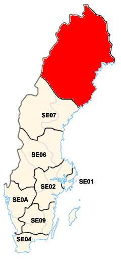
Övre Norrland is the northernmost region of Sweden and forms part of Sápmi (Lapland). It is the Sweden's largest region by area. It borders Norway, Finland, and the riksområde of Middle Norrland.
The most populous cities are Umeå, Luleå, Skellefteå, Piteå and Boden.
Subdivision
Upper Norrland includes 2 counties:
 Norrbotten (seat: Luleå)
 Västerbotten (seat: Umeå)
Economy
The Gross domestic product (GDP) of the region was 27.911 billion € in 2021, accounting for 4.9% of Swedish economic output.[3] GDP per capita adjusted for purchasing power was €35,100 or 116% of the EU27 average in the same year. The GDP per employee was 109% of the EU average.[4]
See also
References
- ↑ Population on 1 January by age, sex and NUTS 2 region
- ↑ "EU regions by GDP, Eurostat". www.ec.europa.eu. Retrieved 18 September 2023.
- ↑ "EU regions by GDP, Eurostat".
- ↑ "Regional GDP per capita ranged from 30% to 263% of the EU average in 2018". Eurostat.
External links
![]() Media related to National areas of Sweden at Wikimedia Commons
Media related to National areas of Sweden at Wikimedia Commons
| |||