Wayne Township | |
|---|---|
 Horney Robinson House, a historic site in the township | |
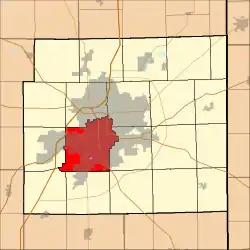 Location of Wayne Township in Allen County, Indiana | |
| Coordinates: 41°02′58″N 85°09′53″W / 41.04944°N 85.16472°W | |
| Country | United States |
| State | Indiana |
| County | Allen |
| Government | |
| • Type | Indiana township |
| Area | |
| • Total | 42.25 sq mi (109.43 km2) |
| • Land | 42.13 sq mi (109.11 km2) |
| • Water | 0.12 sq mi (0.32 km2) |
| Elevation | 774 ft (236 m) |
| Population (2010) | |
| • Total | 103,803 |
| • Density | 2,464/sq mi (951.3/km2) |
| FIPS code | 18-81620[2] |
| GNIS feature ID | 454027 |
| Website | www |
Wayne Township is one of twenty townships in Allen County, Indiana, United States. As of the 2010 census, its population was 103,803.[3]
History
The Horney Robinson House was listed on the National Register of Historic Places in 1985.[4]
Geography
Wayne Township covers an area of 42.25 square miles (109.43 km2), of which 42.13 square miles (109.11 km2) is land and 0.12 square miles (0.32 km2), or 0.29%, is water.[3]
Cities and towns
- Fort Wayne (southwest portion)
Adjacent townships
The township is adjacent to these Indiana townships:
- Aboite (west)
- Adams (east)
- Lafayette (southwest)
- Lake (northwest)
- Marion (southeast)
- Pleasant (south)
- St. Joseph (northeast)
- Washington (north)
Major highways
Cemeteries
The township contains three cemeteries: Lindenwood, Prairie Grove, and Saint Johns.
References
- ↑ "US Board on Geographic Names". United States Geological Survey. October 25, 2007. Retrieved January 31, 2008.
- ↑ "U.S. Census website". United States Census Bureau. Retrieved January 31, 2008.
- 1 2 "Geographic Identifiers: 2010 Demographic Profile Data (G001): Wayne township, Allen County, Indiana". U.S. Census Bureau, American Factfinder. Archived from the original on February 12, 2020. Retrieved March 26, 2013.
- ↑ "National Register Information System". National Register of Historic Places. National Park Service. July 9, 2010.
External links
Municipalities and communities of Allen County, Indiana, United States | ||
|---|---|---|
| Cities | Map of Indiana highlighting Allen County | |
| Towns | ||
| Townships | ||
| CDPs | ||
| Other communities | ||
| Footnotes | ‡This populated place also has portions in an adjacent county or counties | |
This article is issued from Wikipedia. The text is licensed under Creative Commons - Attribution - Sharealike. Additional terms may apply for the media files.