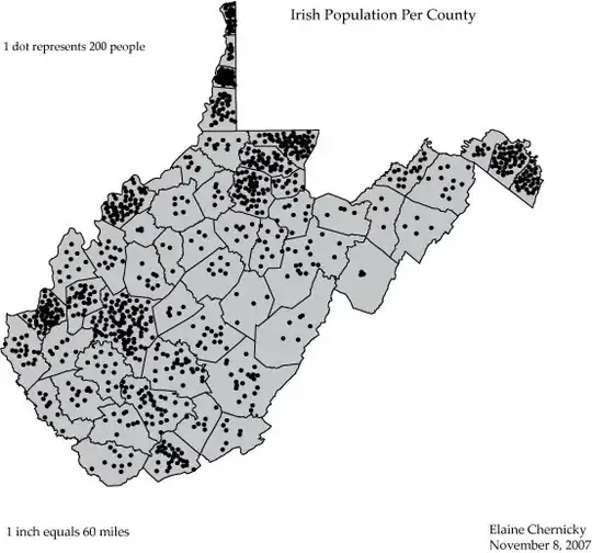
Well, I've come to a very inefficient yet suitable solution to my problem. In case anybody would either like to help me improve my method or use it themselves, this is what I did.
I used this answer as a guide to test whether or not a point would fall in a particular polygon. As I create the polygons that outline the border of counties in my state, I add each latitude to one array, and each longitude to another. I then determine min and max values for each array as a bounding box that a point would have to be in in order to fall within the county lines. I then pick random numbers between those mins and maxes and test whether they fall within the county. If they do, I add a marker there. I do those within a loop that counts how many markers are added until it is proportional to the population of that particular county. Here is the code:
function addMarkers() {
            var loc = "Resources/CaliforniaCounties.json";

            $.getJSON(loc, function (data) {
                $.each(data.features, function (key, val) {

                    var xArray = []; //
                    var yArray = []; //

                    var coords = [];
                    var latlng;
                    var bounds = new google.maps.LatLngBounds();
                    var polygon;

                    $.each(val.geometry.coordinates[0], function (i, item) {
                        latlng = new google.maps.LatLng(item[1], item[0]);
                        xArray.push(item[0]); //
                        yArray.push(item[1]); //
                        coords.push(latlng);
                        bounds.extend(latlng);
                    });

                    var nverts = xArray.length; //
                    var maxX = Math.max.apply(null, xArray);  //
                    var maxY = Math.max.apply(null, yArray);  //
                    var minX = Math.min.apply(null, xArray);  //
                    var minY = Math.min.apply(null, yArray);  //


                    polygon = new google.maps.Polygon({
                        paths: coords,
                        strokeColor: "#000000",
                        strokeOpacity: 1,
                        strokeWeight: 01,
                        fillColor: "#cccccc",
                        fillOpacity: .5
                    });

                    polygon.center = bounds.getCenter();
                    addPolygonClickListener(polygon, val);
                    polygon.setMap(map);

                    polygonArray[val.properties.Name] = polygon;


                    var i = 1;
                    while( i < populations[val.properties.Name] / 10000){
                        var testX = Math.random() * (maxX - minX) + minX; //
                        var testY = Math.random() * (maxY - minY) + minY; //

                        if(pnpoly(nverts, xArray, yArray, testX, testY) == 1){  //
                            var mlatlng = new google.maps.LatLng(testY, testX); //
                            var marker = new google.maps.Marker({ position: mlatlng, icon: "Resources/dot.png", map: map });   //
                            i++;
                        }
                    }


                });
            });

        function pnpoly(nvert, vertx, verty, testx, testy)
        {
           var i, j, c = 0;
           for (i = 0, j = nvert-1; i < nvert; j = i++)
           {
              if ( ((verty[i]>testy) != (verty[j]>testy)) &&
              (testx < (vertx[j]-vertx[i]) * (testy-verty[i]) / (verty[j]-verty[i]) + vertx[i]) )
              {
                 c = !c;
              }
           }
          return c;
        }